Description
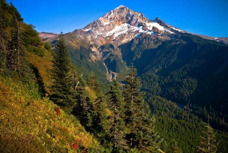
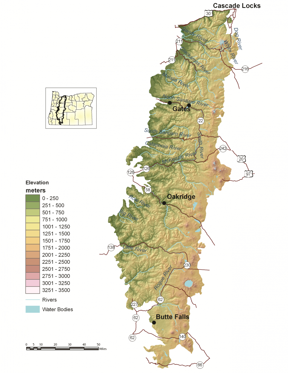
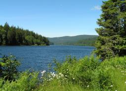
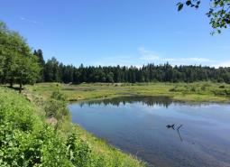
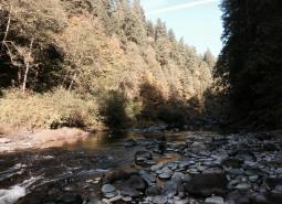
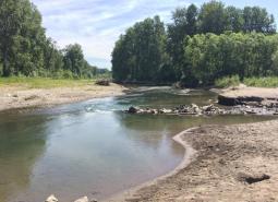
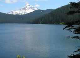
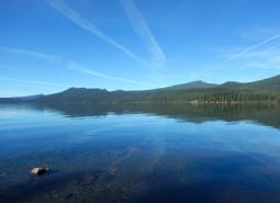
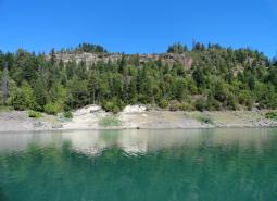
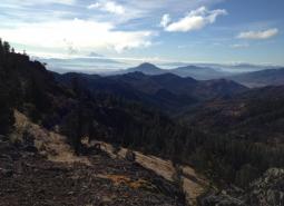
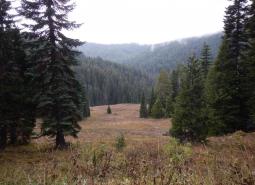
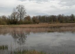
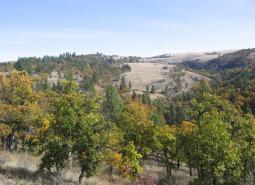
The West Cascades ecoregion extends from just east of the Cascade Mountains’ summit to the foothills of the Willamette, Umpqua, and Rogue Valleys, and spans the entire length of the state of Oregon, from the Columbia River to the California border. The topography and soils of the West Cascades ecoregion have been shaped dramatically by its volcanic past. Geologically, the West Cascades ecoregion has two distinct areas: the younger volcanic crest (approximately 3 million years old) and the “old Cascades” to the west of the crest (at least 30 million years old). The volcanic crest includes the highest peaks in Oregon: Mt. Hood, Mt. Jefferson, and North, Middle, and South Sisters, all more than 10,000 feet. The “old Cascades” are characterized by long, steep ridges and wide, glaciated valleys.
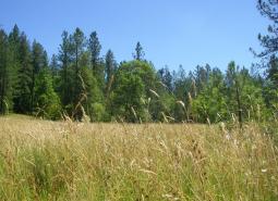
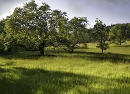
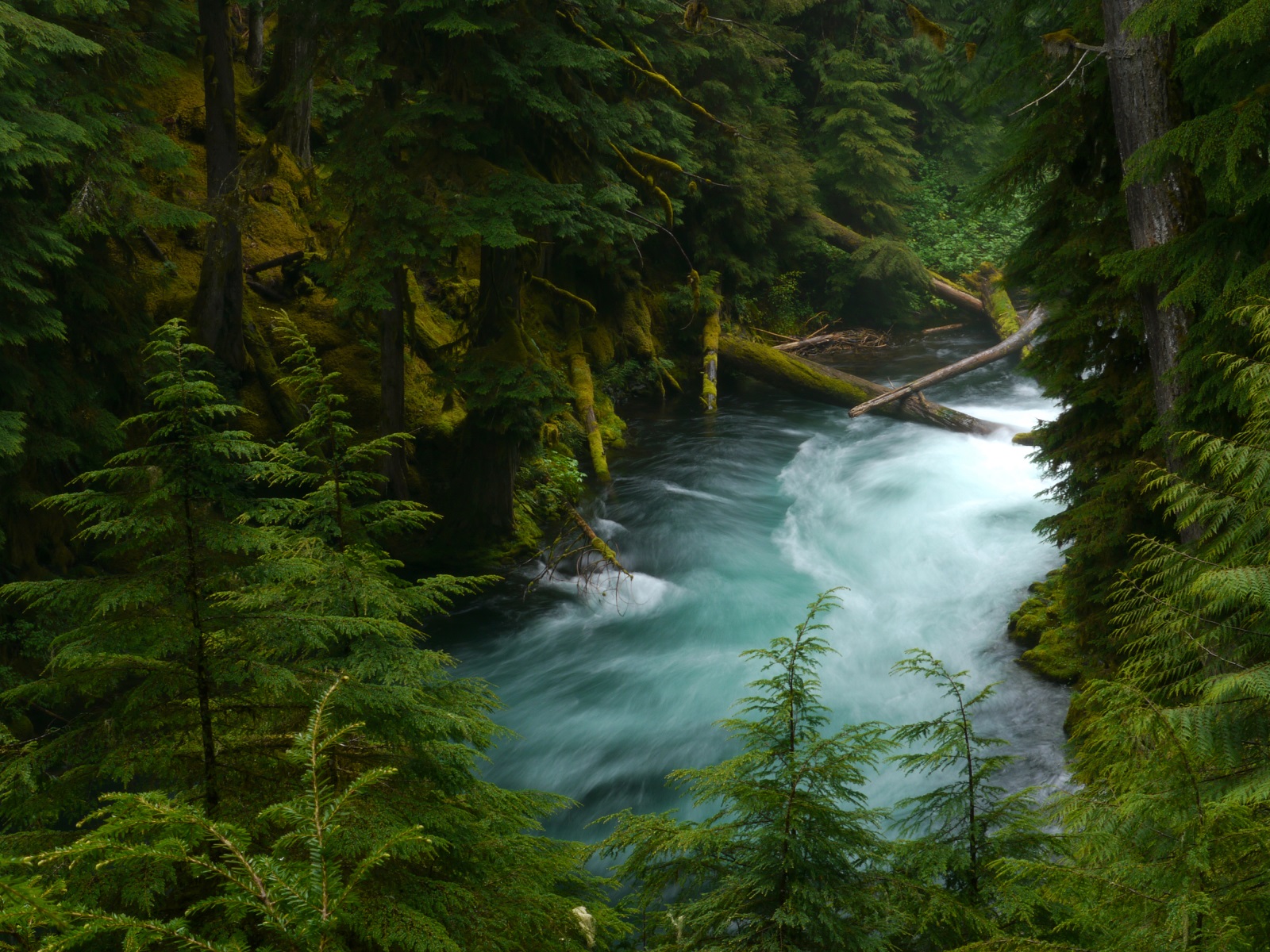
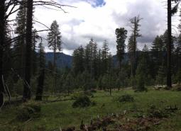
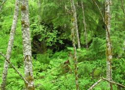
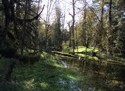
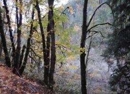
This ecoregion is almost entirely forested by conifers, although the dominant tree species vary by elevation, site characteristics, and stand history. Douglas-fir is the most common tree below 4,000 feet, often with western hemlock as a co-dominant. At higher elevations, dominant tree species include Pacific silver fir, mountain hemlock, or subalpine fir. Other common conifers include western red cedar, grand fir, and noble fir. Above approximately 7,000 feet, the conditions are too severe for tree growth, and alpine parklands and dwarf shrubs predominate, including some wetlands and barren expanses of rock and ice. The climate and resulting fire regime vary with latitude and elevation. Fire regimes in the forests vary across the ecoregion, with the northern portion of the ecoregion seeing less frequent but more severe fires, whereas the southern portion is typically drier with frequent, lightning-caused fires. In the southern areas, ponderosa pine, sugar pine, and incense cedar often are found with Douglas-fir at the lower elevations. At the lower elevations, winter conditions are mild with high rainfall. Above 4,000 feet, much of the precipitation occurs as snowfall.
The West Cascades ecoregion houses just over 1 percent of Oregon’s population, mostly in towns including Cascade Locks, Butte Falls, Detroit, Gates, Idanha, McKenzie Bridge, Blue River, Oakridge, Westfir, and part of Sweet Home (the remainder of which lies in the Willamette Valley ecoregion). Local economies were once entirely dependent on timber harvest but have been greatly affected as market conditions (long-term and broad-scale changes in the forest products marketplace) and shifts in public forest management priorities have shaped Oregon’s timber industry. Many towns are increasingly promoting recreational opportunities, including hiking, camping, fishing, hunting, birding, mountain biking, and skiing. However, timber harvest is expected to remain important to local West Cascades economies in the future.
Characteristics
Important Industries
Timber, recreation
Major Crops
Fruits, mint
Important Nature-based Recreational Areas
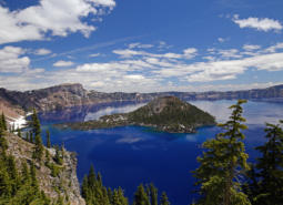
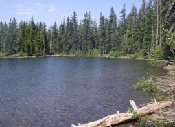
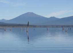
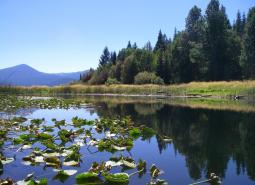
Mt. Hood, Willamette, Umpqua, and Rogue River National Forests; Waldo Lake; Odell Lake; Detroit and Hills Creek Reservoirs; includes about half of Crater Lake National Park
Elevation
98 feet (along the western border of the ecoregion) to 11,040 feet (Cascade peaks)
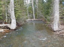
Important Rivers
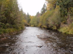
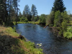
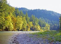
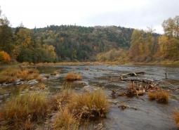
Clackamas (Oak Grove Fork), McKenzie, Rogue, Umpqua, Breitenbush, Middle Santiam, North and Middle Fork of the Willamette
Limiting Factors and Recommended Approaches
Limiting Factor:
Uncharacteristically Severe Wildfire
Many forests in the West Cascades ecoregion are in Fire Regime Condition Class II, with moderate risk of losing one or more ecosystem components. Efforts to reduce risks of uncharacteristically severe fires can help to restore habitat but require careful planning to provide sufficient habitat features that are important to wildlife (e.g., snags, downed logs, hiding cover).
Recommended Approach
Use an integrated approach to wildfire issues that considers historical conditions, wildlife conservation, natural fire intervals, and silvicultural techniques. Encourage forest management at a broad scale to address limiting factors. Reintroduce fire where feasible; prioritize sites and applications. Maintain important wildlife habitat features, such as snags and logs, to sustain dead wood-dependent species. Monitor these efforts, and use adaptive management techniques to ensure efforts are meeting habitat restoration and wildfire prevention objectives with minimal impacts on wildlife.
Limiting Factor:
Invasive Species
Non-native plant and animal invasions disrupt native communities, diminish populations of at-risk native species, and threaten the economic productivity of resource lands.
Recommended Approach
Emphasize prevention, risk assessment, early detection, and quick control to prevent new invasive species from becoming fully established. Prioritize efforts to focus on key invasive species in high priority areas, particularly where Strategy Habitats and Strategy Species occur. Where needed, use multiple site-appropriate tools (e.g., mechanical, chemical, and biological) to control the most damaging invasive species. Promote the use of native species for restoration and revegetation.
Limiting Factor:
Passage Barriers
Passage barriers, such as dams and culverts, reduce available habitat for fish and aquatic species in the West Cascades.
Recommended Approach
Continue working with Oregon Watershed Enhancement Board, Oregon Department of Transportation, Oregon Department of Forestry, USFS, BLM, counties, local municipalities, irrigation districts, and other partners to inventory, prioritize, and provide fish passage at artificial obstructions, leveraging current work done by ODFW’s Fish Passage Task Force to expand implementation of fish passage priorities.
Limiting Factor:
Increasing Recreational Activity
Increasing demands for year-round recreational activity, including new mountain bike trails, ski lifts, and skill parks, can disturb wildlife. Ski seasons are becoming shorter, contributing to the demand for year-round recreational activity.
Recommended Approach
Plan new recreational trail systems carefully and with consideration for native wildlife and their habitats. For example, limit night riding to certain areas to minimize disturbance to wildlife, avoiding areas more sensitive to damage such as wetlands. Take advantage of abandoned or closed roads, rail lines, or previously impacted areas for conversion into trails. Work with the land management agencies such as the USFS to designate areas as high value recreation and low habitat impact areas.
Strategy Species
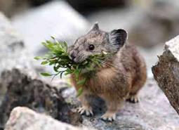
American Pika
Ochotona princeps
Beller’s Ground Beetle
Agonum belleri
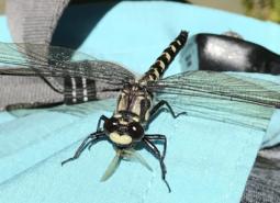
Black Petaltail
Tanypteryx hageni
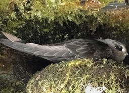
Black Swift
Cypseloides niger borealis
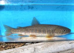
Bull Trout, Deschutes SMU
Salvelinus confluentus
Bull Trout, Hood SMU
Salvelinus confluentus
Bull Trout, Klamath Lake SMU
Salvelinus confluentus
Bull Trout, Odell Lake SMU
Salvelinus confluentus
Bull Trout, Willamette SMU
Salvelinus confluentus
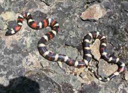
California Mountain Kingsnake
Lampropeltis zonata
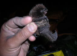
California Myotis
Myotis californicus
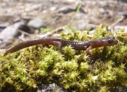
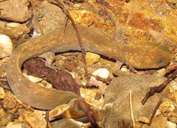
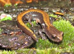
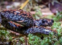
Cascade Torrent Salamander
Rhyacotriton cascadae
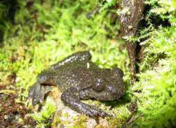
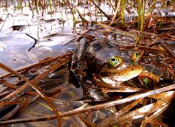
Cascades Frog
Rana cascadae
Clouded Salamander
Aneides ferreus
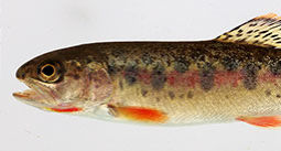
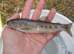
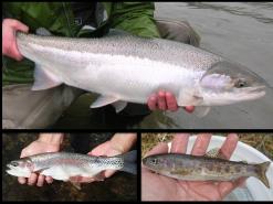
Coastal Cutthroat Trout
Oncorhynchus clarki clarki
Coastal Tailed Frog
Ascaphus truei
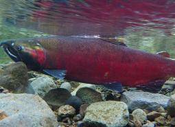
Coho Salmon, Lower Columbia SMU
Oncorhynchus kisutch
Coho Salmon, Rogue SMU
Oncorhynchus kisutch
Columbia Gorge Caddisfly
Neothremma andersoni
Columbia Gorge Hesperian
Vespericola depressa
Cope’s Giant Salamander
Dicamptodon copei

Fall Chinook Salmon, Lower Columbia SMU
Oncorhynchus tshawytscha
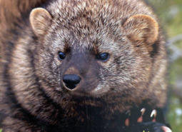
Fisher
Pekania pennanti
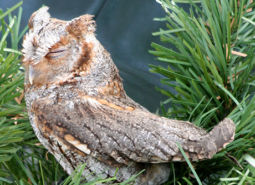
Flammulated Owl
Psiloscops flammeolus
Foothill Yellow-legged Frog
Rana boylii
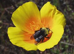
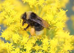
Franklin’s Bumble Bee
Bombus franklini
Fringed Myotis
Myotis thysanodes
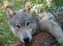
Gray Wolf
Canis lupus
Great Basin Redband Trout, Upper Klamath Basin SMU
Oncorhynchus mykiss newberrii
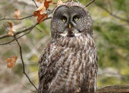
Great Gray Owl
Strix nebulosa
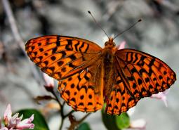
Great Spangled Fritillary
Speyeria cybele

Greater Sandhill Crane
Antigone canadensis tabida
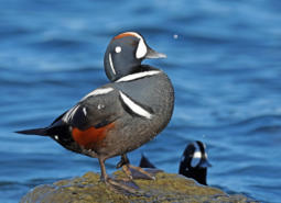
Harlequin Duck
Histrionicus histrionicus
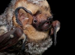
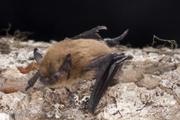
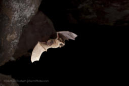
Hoary Bat
Lasiurus cinereus
Larch Mountain Salamander
Plethodon larselli
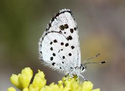
Leona’s Little Blue Butterfly
Philotiella leona
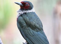
Lewis’s Woodpecker
Melanerpes lewis
Long-legged Myotis
Myotis volans
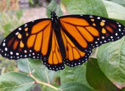
Monarch Butterfly
Danaus plexippus
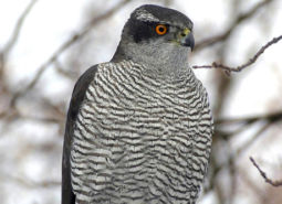
Northern Goshawk
Accipiter gentilis atricapillus
Northern Red-legged Frog
Rana aurora
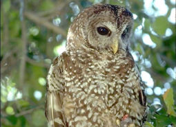
Northern Spotted Owl
Strix occidentalis caurina
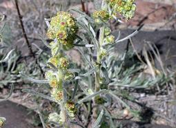
Northern Wormwood
Artemisia campestris var. wormskioldii
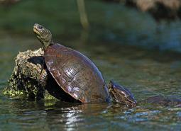
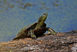
Northwestern Pond Turtle
Actinemys marmorata
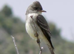
Olive-sided Flycatcher
Contopus cooperi
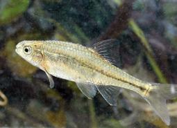
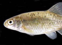
Oregon Chub
Oregonichthys crameri
Oregon Shoulderband
Helminthoglypta hertleini
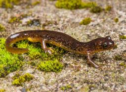
Oregon Slender Salamander
Batrachoseps wrighti
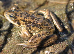
Oregon Spotted Frog
Rana pretiosa
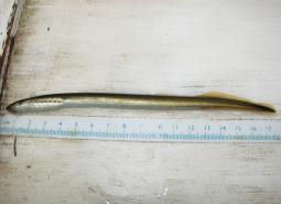
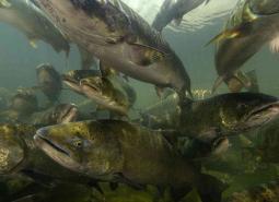
Pacific Lamprey
Entosphenus tridentatus
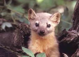
Pacific Marten
Martes caurina
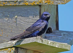
Purple Martin
Progne subis arboricola
Red Tree Vole
Arborimus longicaudus
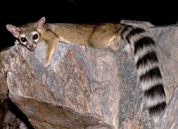
Ringtail
Bassariscus astutus
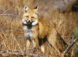
Sierra Nevada Red Fox
Vulpes vulpes necator
Silver-haired Bat
Lasionycteris noctivagans
Spring Chinook Salmon, Coastal SMU
Oncorhynchus tshawytscha
Spring Chinook Salmon, Lower Columbia SMU
Oncorhynchus tshawytscha
Spring Chinook Salmon, Rogue SMU
Oncorhynchus tshawytscha
Spring Chinook Salmon, Willamette SMU
Oncorhynchus tshawytscha
Summer Steelhead / Coastal Rainbow Trout, Coastal SMU
Oncorhynchus mykiss / Oncorhynchus mykiss irideus
Summer Steelhead / Coastal Rainbow Trout, Lower Columbia SMU
Oncorhynchus mykiss / Oncorhynchus mykiss irideus
Summer Steelhead / Coastal Rainbow Trout, Rogue SMU
Oncorhynchus mykiss / Oncorhynchus mykiss irideus
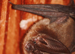
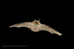
Townsend’s Big-eared Bat
Corynorhinus townsendii
Umpqua Chub
Oregonichthys kalawatseti
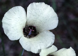
Umpqua Mariposa Lily
Calochortus umpquaensis
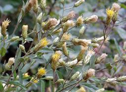
Wayside Aster
Eucephalus vialis
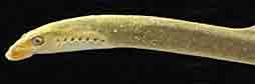
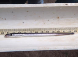
Western Brook Lamprey
Lampetra richardsoni
Western Bumble Bee
Bombus occidentalis
Western Painted Turtle
Chrysemys picta bellii
Western River Lamprey
Lampetra ayresii
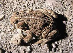
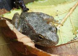
Western Toad
Anaxyrus boreas
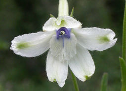
White Rock Larkspur
Delphinium leucophaeum
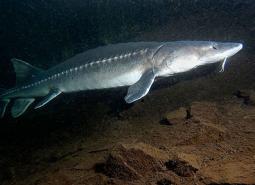
White Sturgeon
Acipenser transmontanus
Winter Steelhead / Coastal Rainbow Trout, Lower Columbia SMU
Oncorhynchus mykiss / Oncorhynchus mykiss irideus
Winter Steelhead / Coastal Rainbow Trout, Willamette SMU
Oncorhynchus mykiss / Oncorhynchus mykiss irideus
Conservation Opportunity Areas
Antelope Creek-Paynes Cliffs [COA ID: 099]
This area includes important and rare low eleveation rocky outcropping and cliff habitat as well as Antelope Creek, historically one of the biggest producers of Summer Steelhead in the Rogue Watershed.
Big Butte Area [COA ID: 122]
This area is in the foothills of the West Cascades ecoregion and contains important Oak Woodland and Ceanothus Shrubland habitats.
Big Marsh Creek [COA ID: 133]
Area includes river headwaters near Crescent Lake Junction and flows into Oregon Cascades National Recreation Area.

Breitenbush River [COA ID: 110]
Area contains mid to high elevation managed forest and tributaries of the North Santiam River.
Bull of the Woods, North [COA ID: 108]
Areas is north of the Bull of the Woods Wilderness Area in the Mount Hood National Forest and contains the headwaters of the Clackamas River.
Bull Run-Sandy Rivers [COA ID: 105]
Area includes the headwaters of the Sandy River and its tributaries including the Bull Run River. Much of area is located within the Mt. Hood National Forest.
Calapooia River [COA ID: 082]
The Calapooia River Corridor spans from Albany through Tangent, Brownsville and through the Holley area.
Central Cascades Crest, Southeast [COA ID: 116]
Directly adjacent to the Upper Deschutes River COA.
Central Cascades Crest, West [COA ID: 113]
Partially bounded by the North Santiam River to the north, the McKenzie River to the west, and the Middle Fork Willamette to the south. Area encompasses significant high-quality fish and wildlife habitat next to wilderness areas managed for their conservation values
Clackamas River and Tributaries [COA ID: 065]
Area extends from the Willamette River area upstream to Estacada and includes floodplain, tributaries, and upland habitats.
Coburg Ridge [COA ID: 087]
Ridgeline, foothills, and associated lowlands bordering the east side of the ecoregion from Coburg Ridge to Indian Head
Crater Lake [COA ID: 121]
Crater Lake, Crater Lake National Park and surrounding wetlands and forest habitats.
Hood River [COA ID: 106]
Area includes Hood River mainstem, East and Middle Fork and numerous tributaries from confluence with Columbia River upstream. and
King Mountain Area [COA ID: 095]
This area contains federal lands intermixed with private ownership in a checkerboard matrix. Habitat is diverse inlcuding mature conifer forests, open early seral habitat created by logging, and oak woodlands. The area may serve as a possible movement corridor connecting the introduced southern Cascade Pacific Fisher population to the native Northern California/Southern Oregon population.
Little North Santiam River Area [COA ID: 109]
Area includes headwaters of North Santiam and Pudding Rivers, comprised largely of National Forest lands, private industrial forest and state-owned recreational areas.
Lower Sandy River [COA ID: 057]
This area is comprised of the 1,500-acre Sandy River Delta at the confluence of the Sandy and Columbia Rivers, plus the Lower Sandy River and its tributaries, including Beaver Creek and the lower reaches of the Bull Run River. Located east of the Portland Metro area in the Columbia River Gorge National Scenic Area.
McKenzie River Area [COA ID: 114]
Area includes an important stretch of the McKenzie River, beginning just west of Willamette National Forest land and following the McKenzie through the city of Eugene
Metolius River Area [COA ID: 127]
Includes Metolius River basin, includes Green Ridge, and extends to include nearby valleys. Nationally known scenic recreation area that provides high quality habitat for fish and wildlife in Central Oregon.
Middle Fork Willamette River [COA ID: 115]
Follows a significant stretch of the Middle Fork Willamette River and its surrounding riparian and upland habitat, bounded to the west by the town of Dexter and extending east to the Oakridge Airport.
Middlefork Willamette River Headwaters [COA ID: 118]
Area includes a significant stretch of the Middle Fork Willamette River, from Hills Creek Reservoir to the north and extending east towards Summit Lake and the Diamond Peak Wilderness Area boundary
Missouri Ridge [COA ID: 070]
Area is located between Scotts Mills and Molalla in the Rock Creek subbasin, a tributary of the Pudding River.
Mt Hood Area [COA ID: 107]
Area is located within Mount Hood National Forest and includes the headwater streams of Hood, Clackamas, Sandy and White Rivers.
Mt Jefferson Wilderness, North [COA ID: 111]
Area is adjacent to Mount Jefferson Wilderness and includes headwaters of Clackamas, North Santiam and Deschutes Rivers.
North Umpqua River Area [COA ID: 090]
Near Roseburg, area includes a significant stretch of the North Umpqua River and its tributaries, and includes surrounding riparian and upland habitats
Odell Lake-Davis Lake [COA ID: 117]
Includes Davis Lake and surrounding habitat, continuing west to Salt Creek and encompassing the Crescent Lake Airport
One Horse Slough-Beaver Creek [COA ID: 083]
Area is located along the ecoregion boundary east of Albany adjacent to South Santiam River. The majority of the area is located in the One-horse slough quad
Pelican Butte-Sky Lakes Area [COA ID: 123]
At the ecoregion boundary adjacent to the East Cascades, and immediately adjacent to the Upper Klamath Lake COA in the East Cascades
Quartzville Creek Area [COA ID: 112]
Area includes Quartzville Creek, a major tributary of the Middle Santiam River, and is largely comprised of federally managed late-successional mixed conifer forest southwest of Mount Jefferson.
Rock Creek [COA ID: 120]
Relatively small (31 sq mi) COA encompassing an important stretch of Rock Creek. Area connects Umpqua Headwaters COA and North Umpqua COA, providing important fish and wildlife habitat connectivity.
Santiam Confluences [COA ID: 078]
The North Santiam River Corridor that borders Linn and Marion Counties from the confluence with the Willamette River through confluences of Jefferson ditch and Valentine Creek near Stayton and the South Santiam River ‘s Confluences with Spring Branch, Thomas Creek, Spring Creek, Crabtree Creek, Onehorse Slough, and Noble Creek to Sweet Home.
Shady Cove Foothills [COA ID: 098]
This area contains important Oregon and California Oak Woodlands and Ceanothus Shrublands. It is
Soda Mountain Area [COA ID: 124]
This area is a transition zone at the nexus of three ecoregions and as a results has a high diversity of species in unique assemblages.
South Fork Umpqua River and Tributaries [COA ID: 091]
Located in the middle of the ecoregion, this COA follows the windy course of the South Umpqua and many of its tributaries. Area boundaries near the towns of Roseburg, Winston, Dillard, Riddle, and Tiller
Umpqua Headwaters [COA ID: 119]
Located within the Umpqua National Forest and includes the headwaters of the Umpqua River.
Upper Deschutes River [COA ID: 129]
Follows the Upper Deschutes River closely from the Cascade Crest.
Upper Klamath Lake Area [COA ID: 138]
Includes Upper Klamath Lake, the largest freshwater lake west of the Rocky Mountains. Area includes surrounding habitat to the north and adjacent to the Sky Lakes area
Upper Siuslaw [COA ID: 089]
Follows the windy Siuslaw River and surrounding habitat. Area builds from the Siuslaw Estuary COA to the west and extends east towards Cottage Grove.
Upper Willamette River Floodplain [COA ID: 061]
This area includes the Willamette River floodplain from South of Springfield in the Dexter/Lowell area north to Albany.
Wasco Oaks [COA ID: 125]
Area extends from the Columbia River up through the Mt. Hood National Forest and has served as an important emphasis for conservation and restoration efforts.