Description
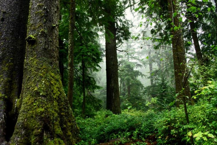
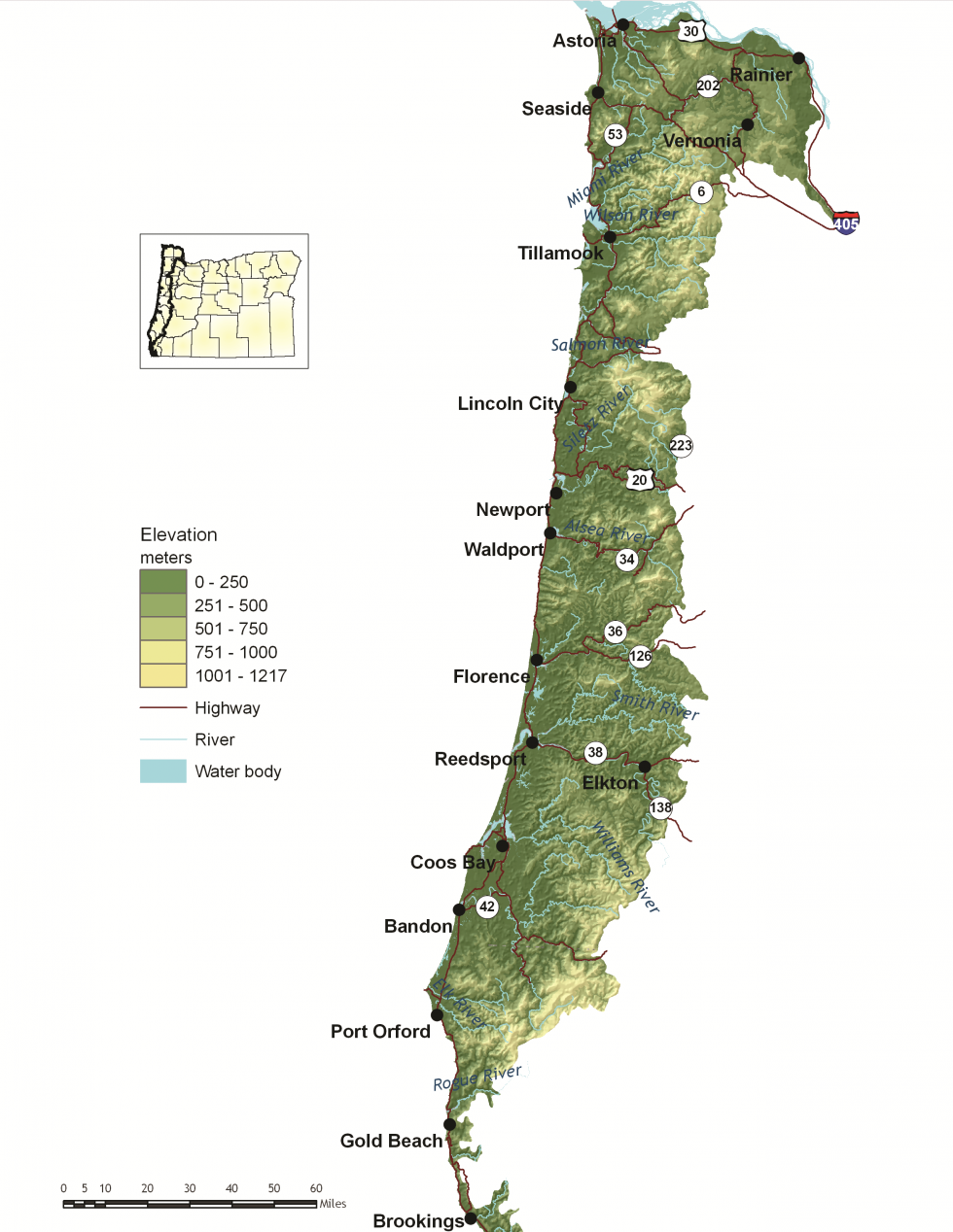
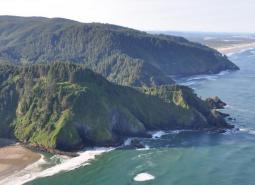
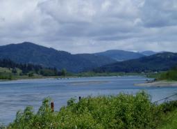
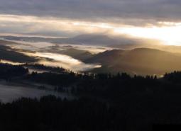
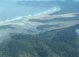
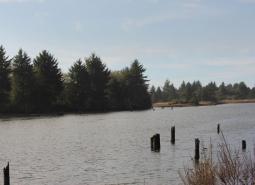
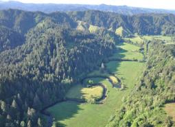
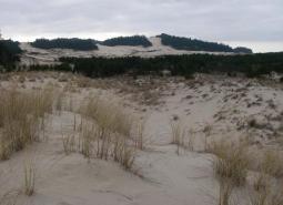
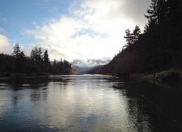
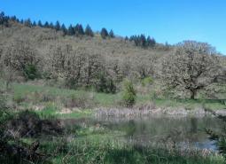
Oregon’s Coast Range is known for its dramatic scenery. It is also extremely diverse, with habitats ranging from open sandy dunes to lush forests and from tidepools to headwater streams. The Coast Range ecoregion includes the entire reach of the Oregon coastline and extends east through coastal forests to the border of the Willamette Valley and Klamath Mountains ecoregions.
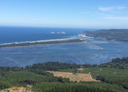
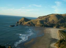
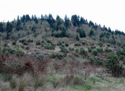
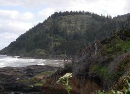
In general, the topography is characterized by steep mountain slopes and sharp ridges. Elevation varies from the ocean shoreline to Marys Peak, which is about 4,100 feet high; however, main ridge summits are approximately 1,400-2,500 feet. The Coast Range ecoregion is bordered by the Nearshore ecoregion on the ocean shores and intersects it in Oregon’s estuaries.
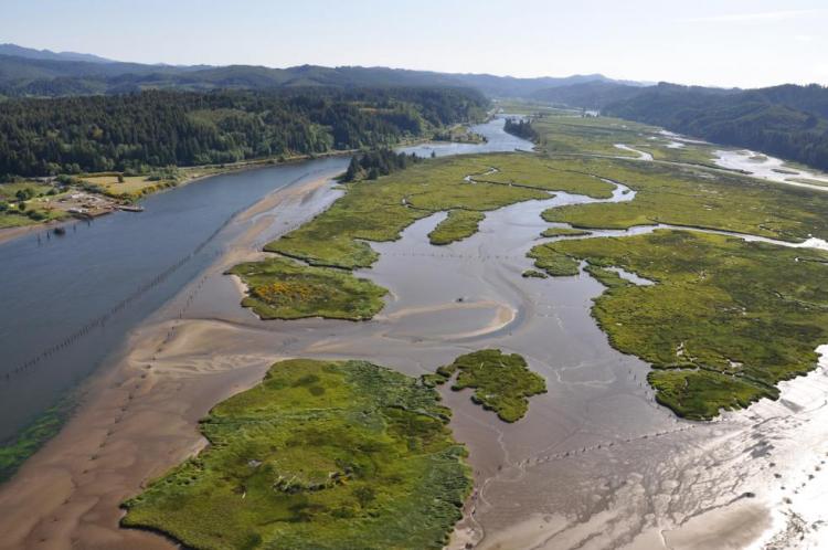
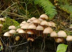
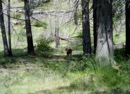
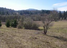
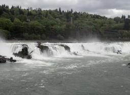
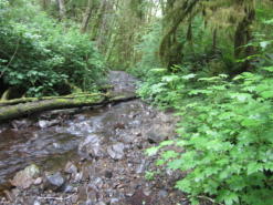
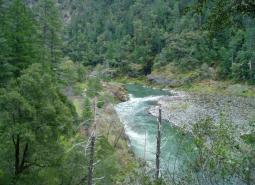
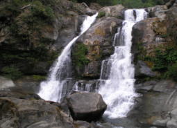
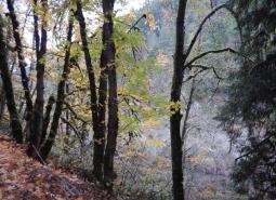
The Coast Range’s climate is influenced by cool, moist air from the ocean, and is the wettest and mildest in the state. The ecoregion’s mild, moist climate creates conditions for highly productive temperate rainforests, which are important ecologically and for local economies. Most of the ecoregion is dominated by coniferous forests. Large forest fires are very infrequent but are severe when they occur. For example, the Tillamook Burn, which is actually a series of wildfires that occurred from 1939-1951, burned approximately 350,000 acres. The Coast Range includes the highest density of streams found in the state, and deciduous riparian vegetation is distinct from surrounding coniferous forests. Along the coastal strip, habitats are influenced by the marine environment and include beaches, estuaries, and headlands.
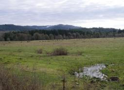
Some towns in Oregon’s Coast Range ecoregion include: Tillamook, Yachats, Astoria, Bandon, Cannon Beach, Elkton, Florence, Gold Beach, Lincoln City, Newport, and Waldport. The largest urban area on the coast is in Coos Bay/North Bend. Because of the bay and the Coos River, this area is a hub for fishing, shellfish, forest products, and transportation. Forestry remains the primary industry in the interior portion of the ecoregion. The Oregon coast offers excellent recreational opportunities, and tourism is important to local communities. Fishing, both commercial and recreational, and fish processing are significant components of the economy. People are increasingly moving to the coast to retire, so retirement services are growing in importance to coastal communities.
Characteristics
Important Industries
Timber, agriculture, commercial fishing, fish processing, tourism and recreation, and retirement services
Major Crops
Livestock forage, beef and dairy cattle
Important Nature-based Recreational Areas
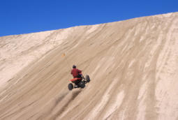
Coos Bay; Tillamook Bay; Oregon sand dunes; Siuslaw and Siskiyou National Forests; Clatsop, Elliot, and Tillamook State Forests; Oregon Dunes National Recreation Area; numerous state parks and waysides
Elevation
From 0 to 4,100 feet
Important Rivers
Alsea, Chetco, Coos, Coquille, Illinois, Lewis and Clark, Necanicum, Nehalem, Nestucca, Rogue, Siletz, Siuslaw, Trask, Umpqua, Wilson, Yaquina, Youngs
Conservation Issues and Priorities
Demand for waterfront property is increasing, along with numbers of people recreating, relocating, and retiring along the Oregon coast. Careful resource planning helps to balance these increasing demands with maintaining coastal fish, wildlife, and habitats. Coordinated, broad-scale planning is especially important given the diversity of the Coast Range ecoregion. For example, the Northwest Forest Plan covers much of the region’s forests. However, the adaptive management component of the Northwest Forest Plan has not been fully implemented. Although many plans currently exist, there is a continuing need to consider the unique requirements of transitional zones such as estuaries, and to integrate marine and inland conservation planning.
Much of the ecoregion is publicly owned and managed to balance recreation, tourism, and conservation. However, ownership in the northern part of the ecoregion is particularly fragmented. Restoration of watershed processes and functions, and restoration of habitat complexity (e.g., woody debris) to stream and riparian areas, are major concerns throughout the entire Coast Range ecoregion. Restoring flows to headwater streams maintains ecological connections important for many species.
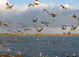
Key Conservation Issues of particular concern in the Coast Range ecoregion include Land Use Changes and Invasive Species. In addition to the statewide issues, oil spills, loss of estuarine habitat, and recreational use are of particular concern in this ecoregion.
Limiting Factors and Recommended Approaches
Limiting Factor:
Land Use Conversion and Urbanization
Some areas of the Coast Range are developing rapidly, especially along the coastline. Steep slopes limit the amount of land available for development, and concentrate it in sensitive areas, such as near rivers and estuaries. Residential development contributes to habitat loss and can threaten traditional land uses, such as agriculture and forestry.
Recommended Approach
Work with community leaders and agency partners to encourage planned, efficient growth. Support existing land use regulations to preserve farmland and forestland, open spaces, recreation areas, wildlife refuges, and natural habitats. Provide outreach about the benefits of wetland and tideland restoration.
Limiting Factor:
Oil Spills
Oil spills along the coast can have devastating effects on coastal habitat, fish, and wildlife. Tidal flux can spread oil or other hazardous materials around sensitive habitats very quickly. Therefore, rapid response in the event of a spill is essential. Additionally, spills of hazardous materials or oil from vehicles traveling on roads along the coast could potentially impact nearby rivers and aquatic species.
Recommended Approach
Ensure rapid response and preparedness for spills of hazardous substances. Oregon Department of Environmental Quality’s (DEQ) Marine Oil Spill Prevention Program and the Pacific States/British Columbia Oil Spill Task Force work with multiple parties and interested partners to address these concerns and quickly identify appropriate actions.
Limiting Factor:
Alterations to Estuarine and Wetland Habitats
Coastal rivers, wetlands, and estuaries were altered long ago when side channels were diked, marshes drained, and channels deepened. These changes impacted fish and wildlife dependent on estuarine habitats.
Recommended Approach
Where possible, remove dikes and tide gates to restore estuarine habitats. Where tide gates need to be retained, replace older gates with new innovations, such as side-hinged and aluminum gates that improve fish passage and hydrologic functions.
Limiting Factor:
Increasing Recreational Use
Recreation contributes positively to the Coast Range’s economy and local communities and is managed carefully in many areas. However, increasing numbers of recreationists can impact sensitive areas, such as shorebird nesting areas and tidepool habitats. There are concerns with off-leash dogs and uncontrolled OHV use in some areas. OHV use and target shooting recreation are increasing on public forestlands, especially just outside of major metropolitan areas. As more land is closed to the public during fire seasons, remaining lands (particularly public lands) are experiencing greater use.
Recommended Approach
Work with state and federal forest management agencies to plan recreational use and to increase education and outreach for recreationists and associated businesses. Where needed, direct activities to particular seasons or away from sensitive areas. Monitor to ensure that OHV rules for use and public lands motor vehicle use maps are enforced by the managing agencies. Improve public awareness of sensitive areas through signage and kiosks.
Limiting Factor:
Invasive Species
Non-native plant and animal invasions disrupt native communities, diminish populations of at-risk native species, and threaten the economic productivity of resource lands and waters.
Recommended Approach
Emphasize prevention, risk assessment, early detection, and quick control to prevent new invasive species from becoming fully established. Prioritize management and control efforts to focus on key invasive species in high priority areas, particularly where Strategy Habitats and Strategy Species occur. Where needed, use multiple site-appropriate tools (e.g., mechanical, chemical, and biological) to control the most damaging invasive species. Work with partners to implement measures to prevent unintentional introduction of non-native species (e.g., implement existing ballast water treatment regulations). Provide information to the public about the ecological and economic damage that invasive species cause.
Strategy Species
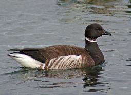
Black Brant
Branta bernicla nigricans
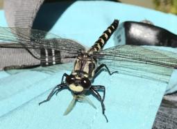
Black Petaltail
Tanypteryx hageni
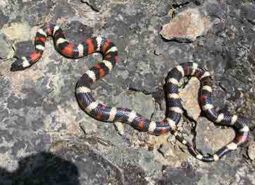
California Mountain Kingsnake
Lampropeltis zonata
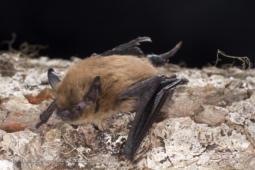
California Myotis
Myotis californicus
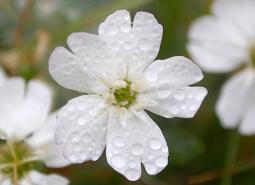
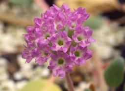
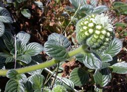
Cascade Head Catchfly
Silene douglasii var. oraria
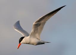
Caspian Tern
Hydroprogne caspia
Chum Salmon, Coastal SMU
Oncorhynchus keta
Chum Salmon, Lower Columbia SMU
Oncorhynchus keta
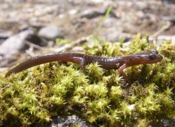
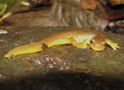
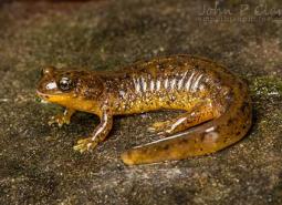
Clouded Salamander
Aneides ferreus
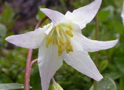
Coast Range Fawn Lily
Erythronium elegans
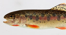
Coastal Cutthroat Trout
Oncorhynchus clarki clarki
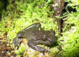
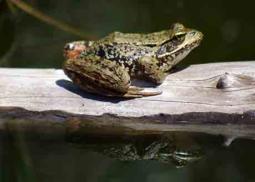
Coastal Tailed Frog
Ascaphus truei
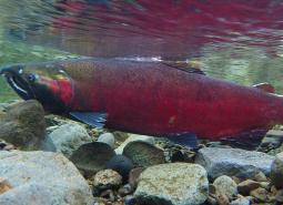
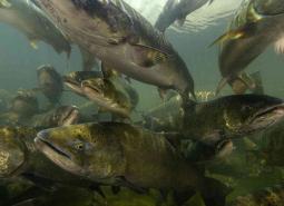
Coho Salmon, Coastal SMU
Oncorhynchus kisutch
Coho Salmon, Lower Columbia SMU
Oncorhynchus kisutch
Coho Salmon, Rogue SMU
Oncorhynchus kisutch
Columbia Torrent Salamander
Rhyacotriton kezeri
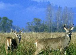
Columbian White-tailed Deer
Odocoileus virginianus leucurus
Cope’s Giant Salamander
Dicamptodon copei
Del Norte Salamander
Plethodon elongatus
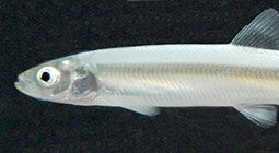
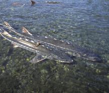
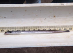
Eulachon
Thaleichthys pacificus

Fall Chinook Salmon, Lower Columbia SMU
Oncorhynchus tshawytscha
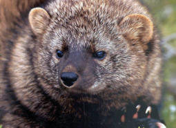
Fisher
Pekania pennanti
Foothill Yellow-legged Frog
Rana boylii
Fringed Myotis
Myotis thysanodes
Green Sturgeon, Northern DPS
Acipenser medirostris
Green Sturgeon, Southern DPS
Acipenser medirostris
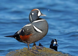
Harlequin Duck
Histrionicus histrionicus
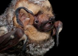
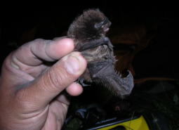
Hoary Bat
Lasiurus cinereus

Hoary Elfin Butterfly
Incisalia polia maritima
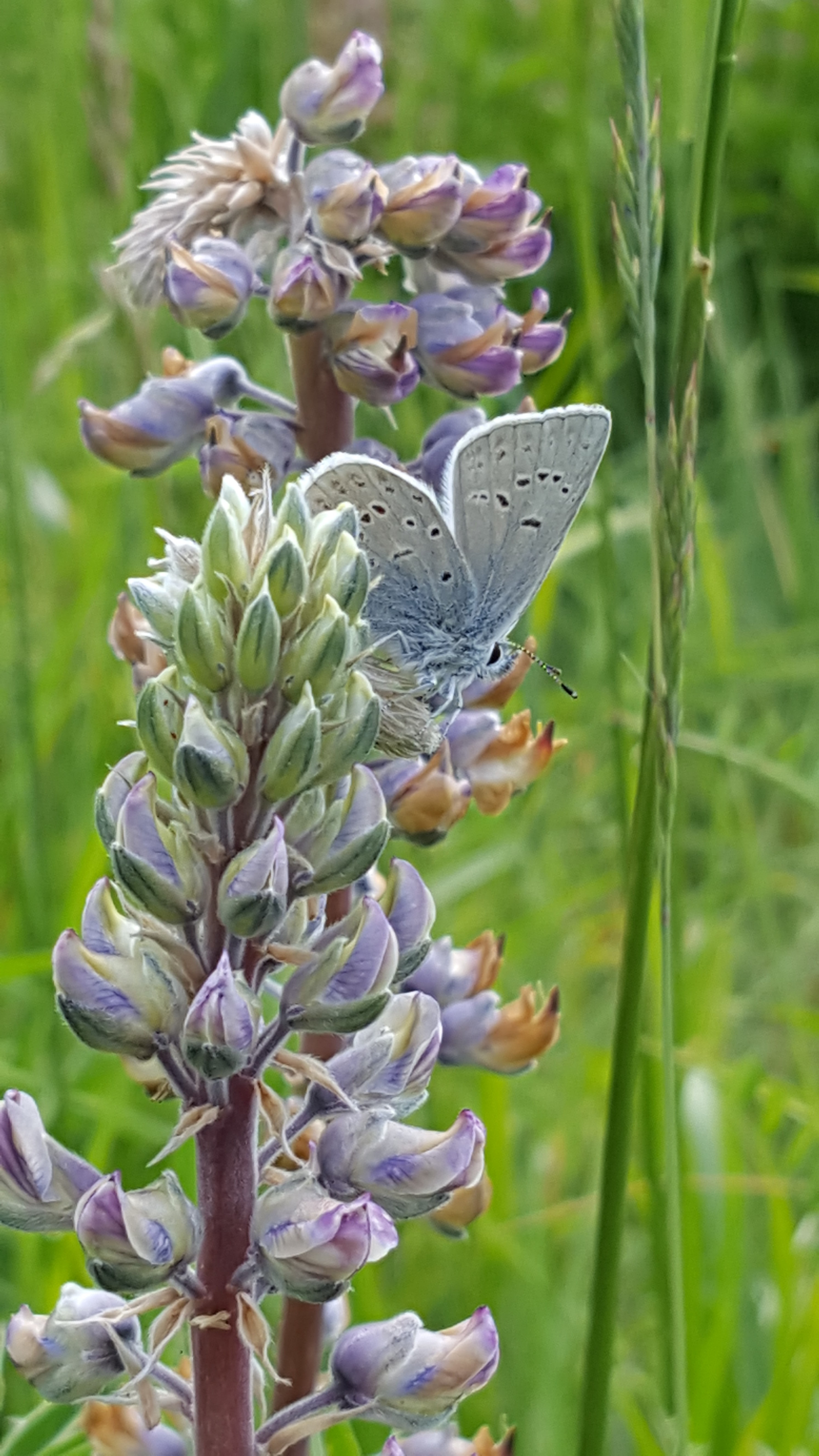
Insular Blue Butterfly
Plebejus saepiolus littoralis

Long-legged Myotis
Myotis volans
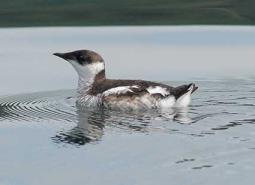
Marbled Murrelet
Brachyramphus marmoratus
Millicoma Dace
Rhinichthys cataractae ssp
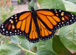
Monarch Butterfly
Danaus plexippus
Nelson’s Checkermallow
Sidalcea nelsoniana
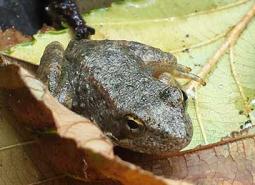
Northern Red-legged Frog
Rana aurora
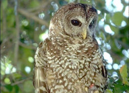
Northern Spotted Owl
Strix occidentalis caurina
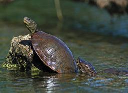
Northwestern Pond Turtle
Actinemys marmorata
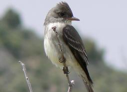
Olive-sided Flycatcher
Contopus cooperi
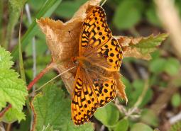
Oregon Silverspot Butterfly
Speyeria zerene hippolyta
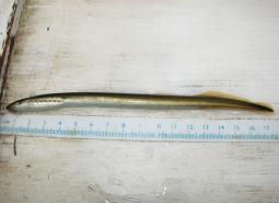
Pacific Lamprey
Entosphenus tridentatus
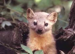
Pacific Marten
Martes caurina
Pacific Walker
Pomatiopsis californica
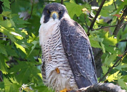
Peregrine Falcon
Falco peregrinus anatum
Pink Sandverbena
Abronia umbellata var. breviflora

Point Reyes Bird’s-beak
Cordylanthus maritimus ssp. palustris
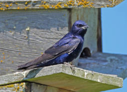
Purple Martin
Progne subis arboricola
Red Tree Vole
Arborimus longicaudus
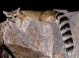
Ringtail
Bassariscus astutus
Robust Walker
Pomatiopsis binneyi
Silver-haired Bat
Lasionycteris noctivagans
Silvery Phacelia
Phacelia argentea
Sisters Hesperian
Hochbergellus hirsutus
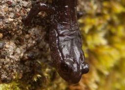
Southern Torrent Salamander
Rhyacotriton variegatus
Spring Chinook Salmon, Coastal SMU
Oncorhynchus tshawytscha
Spring Chinook Salmon, Rogue SMU
Oncorhynchus tshawytscha
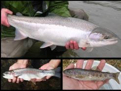
Summer Steelhead / Coastal Rainbow Trout, Coastal SMU
Oncorhynchus mykiss / Oncorhynchus mykiss irideus
Summer Steelhead / Coastal Rainbow Trout, Lower Columbia SMU
Oncorhynchus mykiss / Oncorhynchus mykiss irideus
Summer Steelhead / Coastal Rainbow Trout, Rogue SMU
Oncorhynchus mykiss / Oncorhynchus mykiss irideus
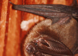
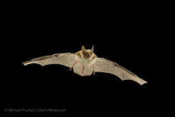
Townsend’s Big-eared Bat
Corynorhinus townsendii
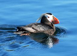
Tufted Puffin
Fratercula cirrhata
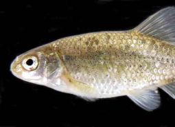
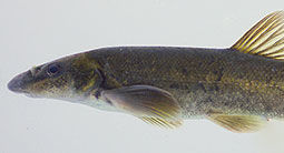
Umpqua Chub
Oregonichthys kalawatseti
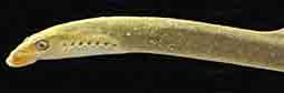
Western Brook Lamprey
Lampetra richardsoni
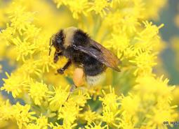
Western Bumble Bee
Bombus occidentalis
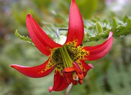
Western Lily
Lilium occidentale
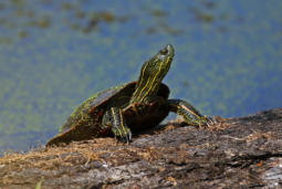
Western Painted Turtle
Chrysemys picta bellii
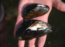
Western Ridged Mussel
Gonidea angulata
Western River Lamprey
Lampetra ayresii
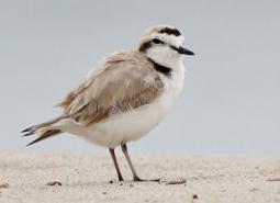
Western Snowy Plover
Charadrius nivosus nivosus
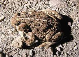
Western Toad
Anaxyrus boreas
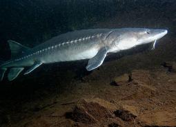
White Sturgeon
Acipenser transmontanus
Winter Steelhead / Coastal Rainbow Trout, Lower Columbia SMU
Oncorhynchus mykiss / Oncorhynchus mykiss irideus
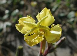
Wolf’s Evening Primrose
Oenothera wolfii
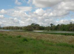
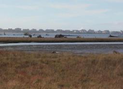
Conservation Opportunity Areas
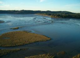
Alsea Estuary-Alsea River [COA ID: 029]
The Alsea Estuary is large and shallow and provides overwintering habitat for migrating waterfowl and rearing habitat for coastal salmonids. The COA also has had extensive salt marsh habitat restoration and contains a lot of public lands.
Beaver Creek [COA ID: 027]
Beaver creek watershed is diverse and productive as habitats start at the beach and move up to the old growth forests.
Cape Ferrelo [COA ID: 051]
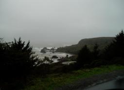
This area includes unique rocky intertidal habitat, important shorebird habitat, and coastal bluffs.
Chetco River-Winhchuck River Estuaries [COA ID: 052]
This diverse area includes habitats ranging from coastal dunes and estuaries to mature upland conifer forests.

Clatskanie River [COA ID: 008]
The area connects with Columbia – Clatskanie COA and contains the entire Clatskanie River watershed. OWEB has granted Lower Columbia Watershed Council and others to reconnect Westport Slough to the Clatskanie River.

Clatsop Plains [COA ID: 001]
This area which is about 30 square miles, is composed of Gearhart Fen the largest contiguous wetland of its kind remaining on the Oregon coast. The Clatsop Plains beaches provide habitat for shorebirds during migration (e.g. Sanderlings) and potential areas for nesting Western Snowy Plovers. The area is conterminal with Necanicum River, Tillamook Head and …

Clatsop State Forest-Jewel Meadows Area [COA ID: 007]
The area includes Clatsop State Forest and Jewel Meadows Wildlife Area and connects with Columbia River – Blind Slough Swamp. The watershed provides critical habitat for many coastal plant and animal communities. The area contains managed forest including components of mature stands and remnant large trees and open upland grassland meadows.

Columbia River-Blind Slough Swamp [COA ID: 006]
This is a an extensive area on the lower Columbia River Estuary from east of Tongue Point upstream to Crims Island. The area encompasses the Julia B. Hanson and Lewis and Clark National Wildlife Refuges and the Blind Slough Swamp Preserve, which contains ancient Sitka spruce trees and is one of the best examples of swamps …

Coos Bay [COA ID: 043]
Encompasses Coos Bay and surrounding habitats. Includes the towns of Coos Bay and North Bend.
Coos Mountain-Middle Creek [COA ID: 044]
Connecting to the Lower Coquille River COA, this area follows Middle Creek northward and includes surrounding riparian and upland habitat
Deer Island [COA ID: 053]
A large (3,000+ acres) island located at River Mile 78-81 along the Lower Columbia River.

Depoe Bay Area [COA ID: 023]
The Depoe Bay COA contains the world’s smallest harbor and has a productive rocky shore and headlands for fish and wildlife use.

Devil’s Lake [COA ID: 020]
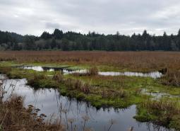
Rock Creek which flows into Devil’s Lake is one of the most important Coho producing streams on the coast. Rock Creek mouth is a peat marsh of several acres in size.

Elliot State Forest [COA ID: 041]
Located immediately adjacent to Tenmile Lakes COA, this area is located inland east from the town of Lakeside. Bounded by Highway 38 and the Umpqua River to the north.
Forest Park [COA ID: 058]
This area in the Tualatin Mountains (Portland’s West Hills) includes the City of Portland’s 5,172-acre Forest Park.
Gales Creek [COA ID: 013]
The area is a late successional mixed deciduous and conifer forest with wetlands, flowing water and riparian habitats in the Gales Creek watershed. The 46 square mile area is conterminal with Nehalem and Salmonberry River Headwaters and Tillamook Bay and Tributaries COAs.
Heceta Head [COA ID: 031]
A coastal headland with nearby steller sea lion haulouts. A large portion of the Siuslaw National Forest is included.
Kalmiopsis Area [COA ID: 100]
This areas borders the western edge of the Kalmiopsis Wilderness and has unique plant communities due to the serpentine soils endemic to the Klamath Mountains ecoregion.
Kings Valley-Woods Creek Oak Woodlands [COA ID: 080]
This corridor in Benton County extends from the south end of Woods Creek Rd. through the town of Wren, along Kings Valley Highway, to the Polk County line

Lower Coquille River [COA ID: 045]
Follows the Lower Coquille River from its mouth at the Oregon coast and extending east to Highway 42 (past the Benham Airport)
Lower Rogue River and Estuary [COA ID: 049]
This are contains the mouth of the Rogue River and is important habitat for Salmonids accessing the rest of the system. It has mature upland forests with a productive hardwood understory that supports a diverse assemblage of wildlife species.
Lower Willamette River Floodplain [COA ID: 059]
The Willamette River mainstem from the confluence with the Columbia River (RM 0) upstream to Willamette Falls in Oregon City (RM26), its floodplain and adjacent uplands.
Luckiamute River and Tributaries [COA ID: 075]
The Luckiamute and Little Luckiamute Rivers and tributary drainages and associated agricultural lands surrounding the Kings Valley Area and South of Falls City.
Mary’s Peak [COA ID: 028]
Covers Mary’s Peak and surrounding wilderness area. Located north of Highway 34 and southwest of Philomath.
McTimmons Valley – Airlie Savanna [COA ID: 076]
Twelve square miles of grassland and oak savanna habitat surrounding McTimmonds Creek, north of Pedee

Mill Creek [COA ID: 024]
Relatively small (15 sq mi) COA at the eastern edge of the Coast Range ecoregion, building from the Red Prairie-Mill Creek – Willamina Oaks COA in the Willamette Valley ecoregion, northwest of the town of Dallas.

Necanicum Estuary [COA ID: 002]
Necanicum is designated as a conservation estuary. The City of Seaside and the North Coast Land Conservancy have acquired a network of tidal wetlands along Neawanna Creek estuary that are designated as a natural history park.
Necanicum River [COA ID: 004]
The area includes much of the Necanicum River. The watershed provides critical habitat for many coastal plant and animal communities. Floodplains and associated wetland and riparian ecosystems provide important flood protection for downstream communities and act as corridors allowing wildlife to move along and between habitat areas. Management of the area promotes the connectivity and …
Nehalem and Salmonberry River Headwaters [COA ID: 012]
The area is a late successional mixed conifer forest with flowing water and riparian habitats in the Nestucca watershed. It is conterminal with Tillamook Bay and Tributaries COA. The area includes much of the watershed of the North Fork Nehalem River.

Nehalem River Estuary [COA ID: 009]
The area includes the Nehalem River watershed from the ocean/estuary close to the headwaters by connection with the North Fork Nehalem COA . The area includes Nehalem Bay State Park. The state park helps to protect the 4-mile north spit from development. In April 2015 Western Snowy Plovers were found attempting to nest at Nehalem …

Nestucca Bay [COA ID: 016]
This area is conterminal with Sand Lake, and Salmon River – Cascade COAs. The area includes Nestucca Bay National Wildlife Refuge, at 1,202 acres, is the largest refuge within the Oregon Coastal Refuge Complex. The refuge also includes Neskowin Marsh, Little Nestucca River Unit, Martella Tract and Two Rivers Peninsula. Neskowin Marsh Unit protects a …

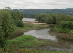
Nestucca River Watershed [COA ID: 017]
A 190 square mile area of coast range mixed and late successional conifer forest, riparian areas of Nestucca River, and freshwater wetlands. Area is conterminal with Nestucca Bay and Trask Mountain COA.
Netarts Bay [COA ID: 014]
This area is conterminal with Sand Lake, Tillamook Bay COAs. The Bay is over 2,300 acres in size and is Oregon’s seventh largest coastal bay. It is bounded on the west by an extensive sand bar/spit. The bay is important for migratory and wintering shorebirds and waterfowl and marine mammals. Historical nesting site for Western …

New River Area [COA ID: 047]
Located on the Oregon Coast, bounded by Cape Blanco Airport to the south and Bandon to the north.

North Fork Nehalem River [COA ID: 010]
The area includes the upper Nehalem River watershed to the headwaters. The area is connected to Nehalem River Estuary Nehalem COA River Estuary. It is identified by the Oregon Plan as important for native salmonids.

North Fork Siuslaw River [COA ID: 032]
A low elevation gradient river meanders to the mainstem Siuslaw river with a mixture of salt and freshwater wetlands
North Fork Smith River [COA ID: 037]
Includes a significant portion of the North Fork Smith River and surrounding upland and riparian habitat, including portions of Siuslaw National Forest
Pistol River Estuary [COA ID: 050]
This area contains the Pistol River Estuary, offshore rocky habitat for nesting seabirds, and Coastal Bluffs.
Red Prairie-Mill Creek-Willamina Oaks South [COA ID: 071]
Area is located south of Highway 19 along Highway 22 in the foothills of the Coast Range Mountains. Includes tributaries of South Yamhill River and associated lowland habitats.
Rickreall Creek and Little Luckiamute River Headwaters [COA ID: 025]
Relatively small, stand-alone COA at the border of the Coast Range ecoregion with the Willamette, just west of Falls City.
Rogue River [COA ID: 093]
This area contains habitat along the mainstem of the Rogue River including portions of the Wild and Scenic area.

Saddle Mountain [COA ID: 005]
The area contains the 3,226 acre Saddle Mountain State Park and state Natural Area, which contains the tallest mountain in Clatsop County (3,283′). Area connects with the Necanicum River watershed. Saddle Mountain is one of eight state natural areas dedicated on state managed lands.
Salmon River Estuary-Cascade Head [COA ID: 019]
This conservation opportunity area provides a unique combination of habitat types, from the rocky shoreline inland and includes the Cascade Head Scenic Research Area. At least 3 threatened and endangered species exist here including the Oregon Silverspot butterfly.
Sand Lake Area [COA ID: 015]
Relatively small (19 sq mi) area on the Oregon coast just north of Pacific City.
Sauvie Island-Scappoose [COA ID: 054]
This area is located north of Portland and is comprised of Sauvie Island, Multnomah Channel, the Scappoose Bay area and the eastern most slopes of Forest Park along Highway 30.
Scoggins Valley-Mount Richmond [COA ID: 063]
Area is located in the foothills of the Coast Range Mountains and includes the Upper Tualatin-Scoggins Watershed, portions of the North Yamhill River and headwater tributaries, Mount Richmond, and the Oak Ridge / Moore’s Valley area.
Siletz Bay [COA ID: 021]
The Siletz estuary is a diverse and complex habitat system, occupied by numerous fish and wildlife species.
Siletz River [COA ID: 022]
This Siletz River COA is a sandstone/basalt river system with variable flashy winter river flows. The surrounding forest are primarily private owned and are actively managed for wood production.
Siuslaw River [COA ID: 035]
This COA stretches many miles from tidally influenced to the Willamette Valley and represents may strategy habitats.

Siuslaw River Estuary [COA ID: 034]
A rather small bay for the size of the river the COA is low elevation and low gradient with many islands and salt/freshwater marshes

Sixes River-Elk River [COA ID: 048]
This area contains much of the Coast Range’s Oak Woodlands and is potential habitat for Western Snowy Plover. It is a key corridor for migrating birds and has high plant and animal diversity.
South Fork Coquille [COA ID: 046]
Relatively large (222 sq mi) area located within the Coast Range near the Rogue River-Siskiyou Forest and immediately adjacent to the Sixes River-Elk River COA

Sutton Lake Area [COA ID: 033]
Sea Level coastal lakes with limited tidal influence and large enough to have cold water and waves
Tahkenitch-Siltcoos Lakes [COA ID: 036]
Two large coastal lakes with floating peat islands and large numbers of wintering waterfowl exist in this COA. Carnivorous pitcher plants (Darlingtonia are found along the edges.

Tenmile Lake [COA ID: 040]
On the Oregon Coast near the town of Lakeside, includes North and South Tenmile Lake and surrounding habitat

Tillamook Bay and Tributaries [COA ID: 011]
A large bay some 6 miles long with five rivers flowing in to it. Extensive sand/mudflats provide habitat for migratory and breeding waterfowl and shorebirds. The bay is protected from the open ocean by a the Bayocean Spit, formerly used by nesting Western Snowy Plovers.

Tillamook Head [COA ID: 003]
This area includes Ecola State Park and surrounding 9 miles of coastline between Seaside and Cannon Beach. The area includes coastal Sitka spruce forest, eventually opening up to a grassy bluff. Sea stacks punctuate the long sweep of shoreline to the south. Offshore islands provide nesting and loafing areas for several species of seabirds.
Trask Mountain [COA ID: 018]
A 37 square mile area of coast range mixed and late successional conifer forest and riparian areas of North Yamhill River wetlands. Area is conterminal with Nestucca River Watershed and Scoggins Valley-Mount Richmond COAs.
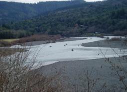
Umpqua River [COA ID: 042]
Area follows the windy Umpqua River and surrounding riparian and upland habitat. Bounded at the north by Elkton and at the south near the towns of Melrose and Winchester
Umpqua River Estuary [COA ID: 038]
Area focuses on the Umpqua River Estuary, bounded by the coastline to the west and Highway 38 to the east
Upper Siuslaw [COA ID: 089]
Follows the windy Siuslaw River and surrounding habitat. Area builds from the Siuslaw Estuary COA to the west and extends east towards Cottage Grove.
Wassen Creek [COA ID: 039]
Connects to the northern portion of Umpqua River Estuary. Focuses on Wassen Creek and surrounding upland and riparian habitats. Includes some Siuslaw National Forest land
West Eugene Area [COA ID: 086]
This site extends from Camas Swale north along the foothills to Cox Butte, including the West Eugene wetlands
Yachats River Area [COA ID: 030]
A narrow river channel with a wide shallow mouth at the ocean, this COA incorporates steep coastal mountains.
Yamhill Oaks-Willamina Oaks North [COA ID: 067]
Area is located west of McMinnville in the foothills of the Coast Range Mountains and within the South Yamhill River Watershed.
Yaquina Bay [COA ID: 026]
The Yaquina estuary COA is a large watershed with numerous fish, wildlife, habitat, and human resources.