Description
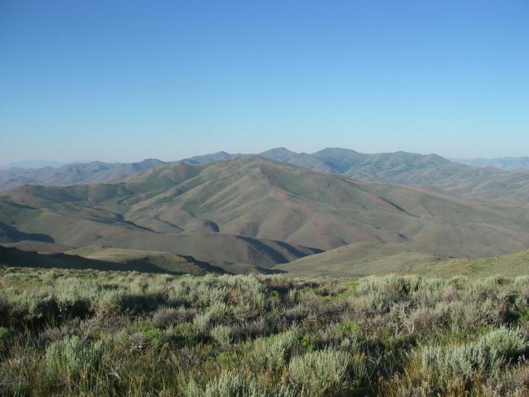
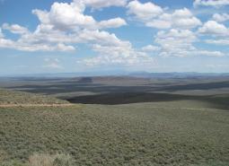
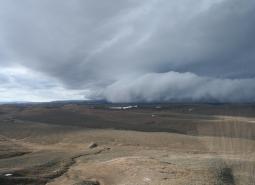
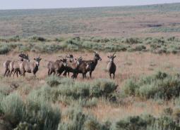
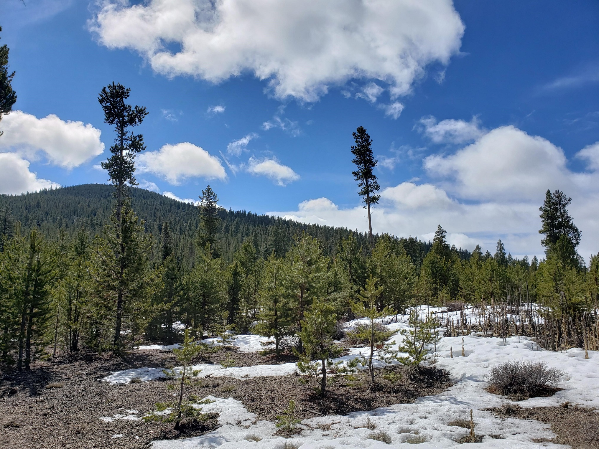
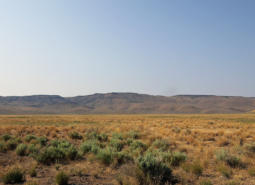
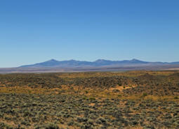
The Northern Basin and Range ecoregion is sagebrush country. It is Oregon’s slice of the Old West, with rich ranching and farming traditions.
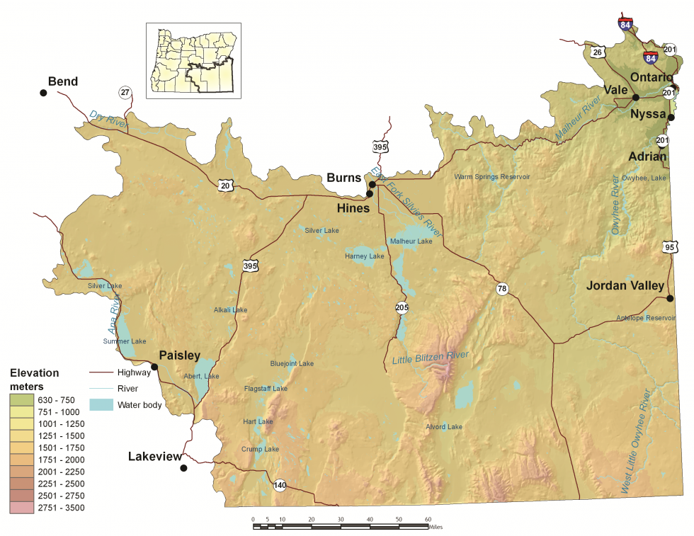
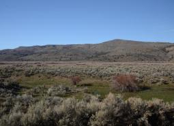
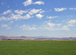
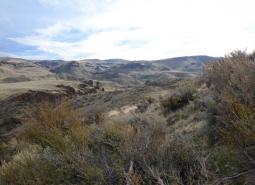
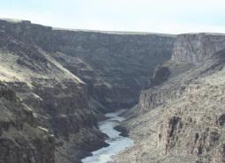
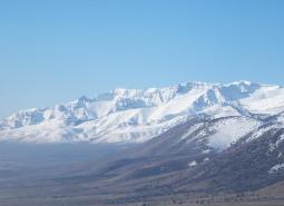
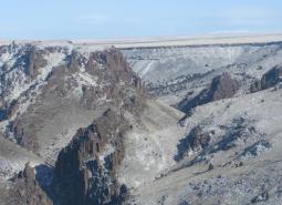
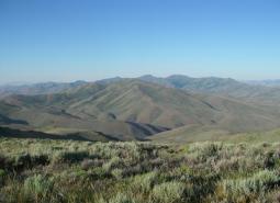
The Northern Basin and Range ecoregion covers the southeastern portion of the state, from Burns south to the Nevada border and from the Christmas Valley east to Idaho. The name describes the landscape, numerous flat basins separated by isolated mountain ranges. Several important mountains are fault blocks, with gradual slopes on one side and steep basalt rims and cliffs on the other side. The Owyhee Uplands consist of a broad plateau cut by deep river canyons. Elevations range from 2,070 feet near the Snake River to more than 9,700 feet on the Steens Mountain.
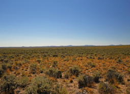
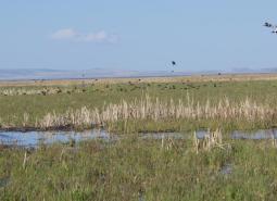
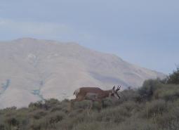
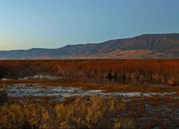
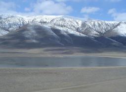
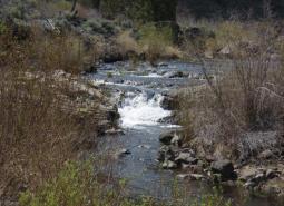
In the rain shadow of the Cascades Mountains, the Northern Basin and Range is Oregon’s driest ecoregion marked by extreme ranges of daily and seasonal temperatures. Much of the ecoregion receives less than 15 inches of precipitation per year, although mountain peaks receive 30-40 inches per year. The extreme southeastern corner of the state has desert-like conditions, with annual precipitation of only 8-12 inches. Runoff from precipitation and mountain snowpack often flows into low, flat playas where it forms seasonal shallow lakes and marshes. Most of these basins contained large, deep lakes during the late Pleistocene, between 40,000 and 10,000 years ago. As these lakes, which don’t drain to the ocean, dried through evaporation, they left salt and mineral deposits that formed alkali flats, extremely important stopover sites for migratory shorebirds due to the rich source of invertebrate prey.
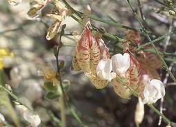
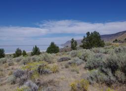
Sagebrush communities dominate the landscape. Due to the limited availability of water, sagebrush is usually widely spaced and associated with an understory of forbs and perennial bunchgrasses, such as bluebunch wheatgrass and Idaho fescue. The isolated mountain ranges have few forests or woodlands, with rare white fir stands in Steens Mountain and Hart Mountain. However, aspen and mountain mahogany are more widespread and can be found in the Trout Creeks, Steens Mountain, Pueblo Mountains, Oregon Canyon Mountain, and Mahogany Mountains. In the southern portion of the ecoregion, there are vast areas of desert shrubland, called salt-desert scrub, dominated by spiny, salt-tolerant shrubs. Throughout the ecoregion, soils are typically rocky and thin, low in organic matter, and high in minerals.
The Northern Basin and Range ecoregion is sparsely inhabited, but the local communities have vibrant cultural traditions. The largest community is Ontario, with more than 11,000 people. Other communities include Nyssa, Vale, Burns, and Lakeview, with 2,400 to 3,100 people each. Land ownership is mostly federal and primarily administered by the BLM. Livestock and agriculture are the foundations of the regional economy. Food processing is important in Malheur County. Recreation is a seasonal component of local economies, particularly in Harney County. Hunting contributes to local economies, as does wildlife viewing, white-water rafting, and camping. Historically, lumber processing and harvesting from the nearby Blue Mountains was the basis of some local communities, particularly for Burns. However, these industries have declined with lower harvests from neighboring federal forests.
Characteristics
Important Industries
Livestock, forest products, agriculture, food processing, recreation
Major Crops
Alfalfa, wheat, hay, corn, oats, onions, sugar beets, potatoes
Elevation
2,070 feet (Snake River) to 9,733 feet (Steens Mountain)
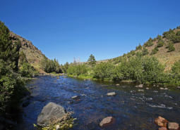
Important Rivers
Donner und Blitzen, Malheur, Owyhee, Silvies
Limiting Factors and Recommended Approaches
Limiting Factor:
Energy Development
Climate change and global economies are increasing pressure for renewable energy development, including wind and geothermal energy. Energy projects offer environmental benefits but also have impacts on fish, wildlife, and their habitats. The Northern Basin and Range ecoregion offers excellent renewable energy resources that are useful to address climate change in the ‘big picture’, but the ecoregion is sensitive to local impacts on sagebrush and other habitats.
Recommended Approach
Plan energy projects carefully, using best available information and consultation with biologists. Use available tools and resources found in the Land Use Changes and Climate Change KCIs and ODFW Compass.
Limiting Factor:
Invasive Species
Invasive plants, including noxious weeds and cheatgrass, are of particular concern in the Northern Basin and Range ecoregion. They disrupt native communities, diminish populations of at-risk native species, and threaten the economic productivity of resource lands. Invasive plants have been increasing during the last 80 years. The spread of cheatgrass and medusahead can increase the frequency, intensity, and spread of fires, replacing sagebrush and native bunchgrasses, which are adapted to infrequent, patchy fires. While not nearly as extensive as invasive plants, non-native animals have also impacted native fish and wildlife populations. For example, invasive carp in Malheur Lake have damaged one of the most important waterfowl production areas in Oregon, altering ecological dynamics through predation and altering water quality by disturbing sediments (see this video clip for more information).
Recommended Approach
Emphasize prevention, risk assessment, early detection, and quick control to prevent new invasive species from becoming fully established. Use multiple site-appropriate tools (e.g., mechanical, chemical, and biological) to control the most damaging invasive species. Prioritize efforts to focus on key invasive species in high priority areas, particularly where Strategy Habitats and Strategy Species occur. Cooperate with partners through habitat programs and county weed boards to address invasive species problems. Use of fire helps treat juniper or medusa head. Carefully manage wildfires in cheatgrass-dominated areas. Promote the use of native “local” stock for restoration and revegetation where native species have the greatest potential to successfully establish. In some cases, use “assisted succession” strategies, applying low seed rates of non-invasive non-native plants in conjunction with native plant seeds as an intermediate step in rehabilitating disturbances in sagebrush communities.
Limiting Factor:
The Spread of Western Juniper and Altered Fire Regimes
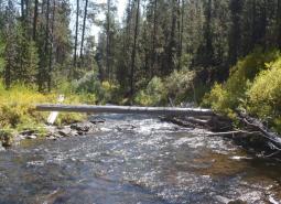
Although an important native woodland tree in the East Cascades ecoregion, western juniper has been rapidly expanding its range over the last 40 years. The reasons for this expansion are not clear, although changes in fire regimes, overgrazing, and climate changes may have a role. This rapid expansion of western juniper has degraded some grassland, sagebrush, riparian, large-diameter juniper, and aspen habitats. Western juniper expansion may reduce water availability in many seasonal and some perennial streams. In many of the grassland and sagebrush habitats, 20-30 year old juniper trees form dense stands that are not suitable for many wildlife species that require open sagebrush or grassland habitats that are now in decline. In riparian areas, junipers replace deciduous shrubs and trees that are more beneficial to riparian wildlife. Western juniper is a native species, and old growth juniper trees in rocky outcrops offer benefits to native wildlife.
Most big sagebrush-dominated areas were once a mosaic of successional stages, from recently burned areas dominated by grasses and forbs to old sagebrush-dominated stands that have not burned for 80 to 300 years. However, changes in fire patterns have reduced this mosaic and resulted in large areas dominated by invasive annual grasses, or older big sagebrush with an understory of invasive annual plants.
Increasingly dry conditions are contributing to increased frequency of fires, resulting in landscapes that are susceptible to the spread of western juniper and cheatgrass. Previously, fire suppression resulted in undesirable changes in vegetation, contributing to the build-up of woody plants that increase the intensity of fires. Areas dominated by cheatgrass or other invasive annual grasses are more conducive to fire ignition and reburning.
While a useful tool, prescribed fire might not be suitable for some sagebrush habitats because some sagebrush communities are very slow to recover from a fire. Big sagebrush communities with non-native invasive annuals in the understory will not recover from fire without significant intervention.
Recommended Approach
Controlling western juniper in newly invaded areas benefits wildlife and other habitat values. Early control of newly invaded young trees before woodlands become established is often the most successful approach.
In some areas, fire can be used to control young juniper. Carefully evaluate sites to determine if prescribed fire is appropriate, considering the landscape context and vegetation types. Under current vegetation management conditions, fire is damaging to sagebrush stands. If determined to be ecologically beneficial, reintroduce natural fire regimes using site-appropriate prescriptions that account for the historical fire regime, as well as area size and vegetation characteristics that affect resiliency and resistance to disturbance. Use prescribed fire to create a mosaic of successional stages, and avoid large prescribed fires.
In areas where prescribed fire is not practical, use mechanical treatment methods (e.g., chipping, cutting for firewood) that minimize soil disturbance. Chemical, mechanical, or biological management techniques can be combined along with prescribed fire.
Develop markets for small juniper trees as a special forest product to reduce restoration costs. Maintain large-diameter juniper trees in the native rocky outcrops and ridges, which are important nesting habitat for passerines and raptors.
Limiting Factor:
Ongoing Recovery From Historical Overgrazing
Prior to limitations that were initiated on public lands in the mid-1930s, livestock grazing had a profound influence on landscapes throughout the Northern Basin and Range ecoregion. Many areas experienced serious ecological damage. Conditions on rangelands in general have improved substantially over the past half-century as a result of improvements in livestock management, and most ecosystems are recovering. However, some habitats have been slow to recover, such as some riparian areas and sagebrush communities, especially where cheatgrass has invaded.
Recommended Approach
Continue to proactively manage livestock grazing and restore degraded habitats. Minimize grazing during restoration of highly sensitive areas, such as wetlands and riparian areas.
Limiting Factor:
Uncontrolled Off-highway Vehicle Use
Use by OHVs continues to increase. While limited and controlled, OHV use can be compatible with wildlife conservation. Unlimited and uncontrolled use can:
- impact riparian, aquatic, and upland habitats
- spread invasive plant seeds
- affect wildlife behavior and distribution, especially during critical breeding and wintering periods
- damage soils
- increase risk of wildfires
Although OHV use is limited to designated roads in some sensitive landscapes, there is little to no enforcement due to lack of funds and law enforcement personnel.
Recommended Approach
Work cooperatively with land managers and OHV groups to direct use to maintained trails in low-impact areas and improve enforcement of existing rules. Support educational efforts to promote low-impact recreational use such as the Tread Lightly! Program. Monitor OHV impacts at priority areas. Support efforts to effectively manage OHV use on public lands, particularly in highly sensitive habitats, and restore damaged areas.
Limiting Factor:
Unmanaged Recreational Use
In addition to OHV use, other recreational use, such as camping, rock climbing, and parasailing, is increasing. Although recreational use is still light in comparison to other ecoregions, new uses could compound impacts to wildlife by increasing disturbance and making previously remote areas more accessible to people.
Recommended Approach
Proactively consider potential impacts to wildlife and habitats when developing or promoting recreational opportunities to encourage compatible uses. Monitor recreational patterns and trends.
Limiting Factor:
Unregulated Horse Herds Disturb Wildlife and Compete for Water and Other Resources
Oregon’s herds of wild horses are a well-recognized feature on rangeland, but the herds require intensive management attention, including resource-intensive adoption and translocation programs allowed under the Wild Horse & Burro Act (BLM 1971). Unregulated horse herds negatively impact native vegetation, compete with wildlife for water and food, and disrupt habitat use by wildlife. The effects of climate change are likely to exacerbate these impacts.
Recommended Approach
Promote dialogue between wildlife managers, land owners, and land managers to develop management plans based on common priorities. Managing horse and burro populations is critical, both for their well-being and for ecosystem health. Promote outreach to explain the issue to the public. Use opinion polling results to inform management decisions and help agencies balance multiple priorities.
Limiting Factor:
Water Distribution in Arid Areas and Wildlife Entrapment in Water Developments
In arid areas, water availability can limit animal distribution. Water developments established for domestic livestock and wildlife can significantly benefit birds, bats, and small mammals. However, some types of these facilities, particularly water developments for large ungulates, can have unintentional hazards. These hazards include over-hanging wires that act as trip lines for bats, steep side walls that act as entrapments under low water conditions, or unstable perches that cause animals to fall into the water. If an escape ramp is not provided, small animals cannot escape and will drown.
Recommended Approach
Continue current efforts to provide water for wildlife in arid areas. Continue current design of big game “guzzlers” that accommodate a variety of species, and retrofit older models where appropriate to make them compatible with newer design standards. Use and maintain escape devices on water developments where animals can become trapped. Remove obstacles that could be hazardous to wildlife from existing developments.
Strategy Species
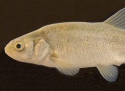
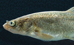
Alvord Chub
Siphateles alvordensis
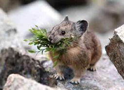
American Pika
Ochotona princeps
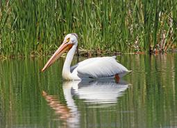
American White Pelican
Pelecanus erythrorhynchos
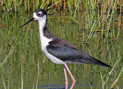
Black-necked Stilt
Himantopus mexicanus
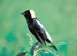
Bobolink
Dolichonyx oryzivorus
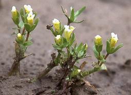
Boggs Lake Hedge Hyssop
Gratiola heterosepala
Borax Lake Chub
Siphateles boraxobius

Borax Lake Ramshorn
Planorbella oregonensis
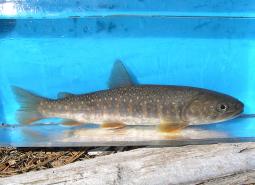
Bull Trout, Malheur River SMU
Salvelinus confluentus
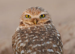
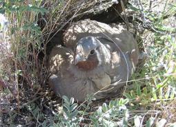
Burrowing Owl
Athene cunicularia hypugaea
California Myotis
Myotis californicus
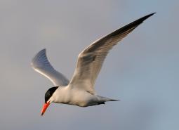
Caspian Tern
Hydroprogne caspia
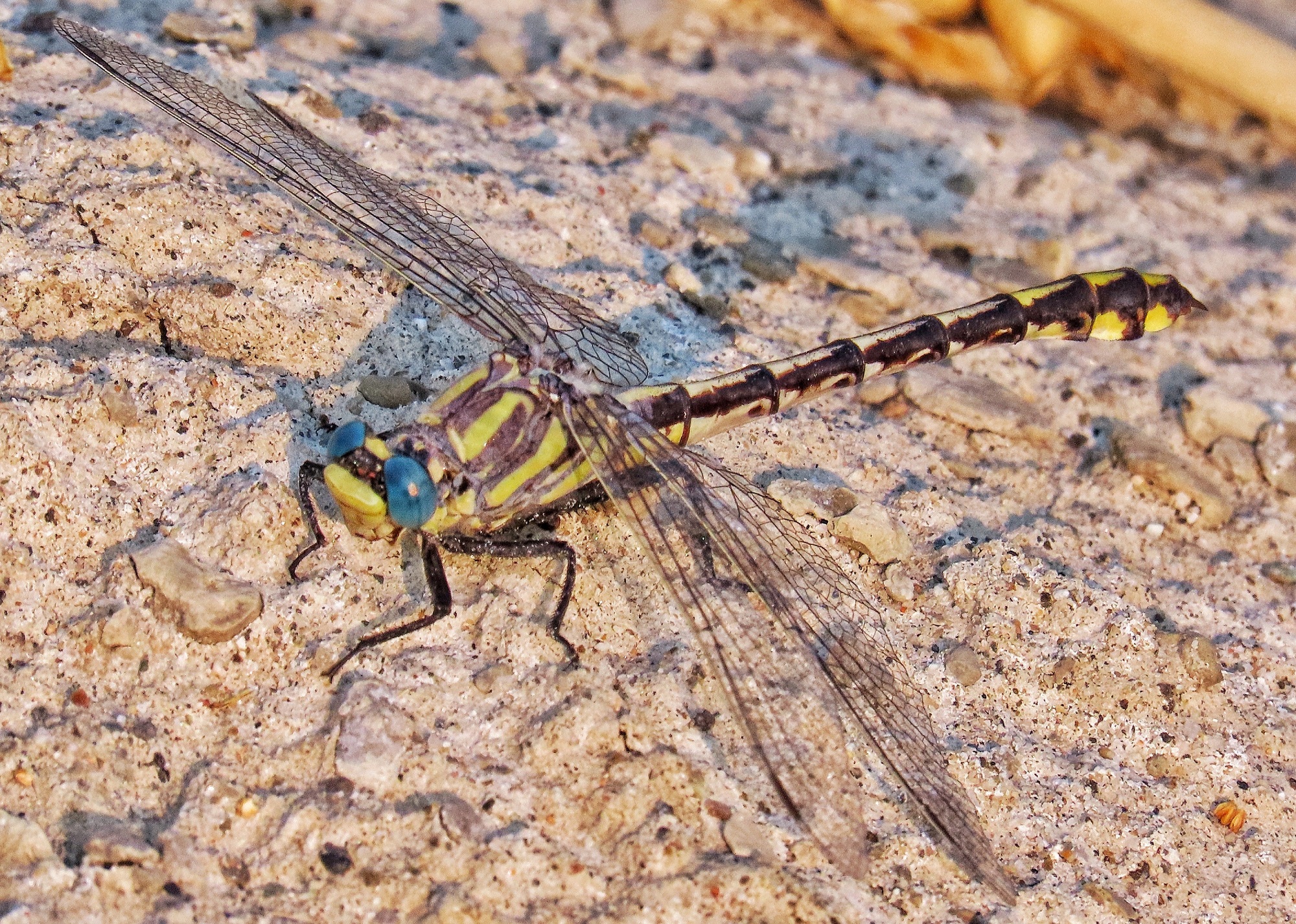
Columbia Clubtail
Gomphus lynnae
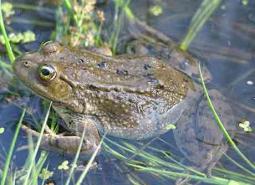
Columbia Spotted Frog
Rana luteiventris
Cronquist’s Stickseed
Hackelia cronquistii
Crosby’s Buckwheat
Eriogonum crosbyae
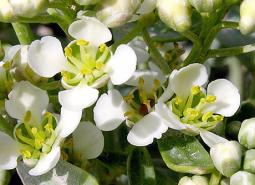
Davis’ Peppergrass
Lepidium davisii
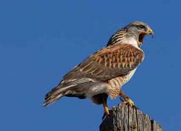
Ferruginous Hawk
Buteo regalis
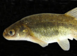
Foskett Spring Speckled Dace
Rhinichthys osculus robustus
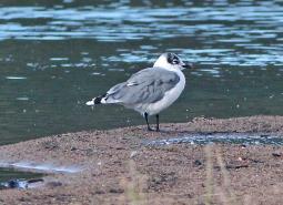
Franklin’s Gull
Leucophaeus pipixcan

Fringed Myotis
Myotis thysanodes
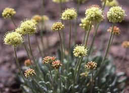
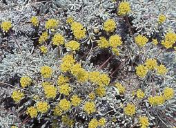
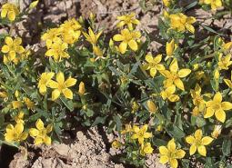
Golden Buckwheat
Eriogonum chrysops
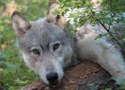
Gray Wolf
Canis lupus
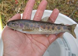
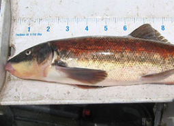
Great Basin Redband Trout, Catlow Valley SMU
Oncorhynchus mykiss newberrii

Great Basin Redband Trout, Chewaucan SMU
Oncorhynchus mykiss newberrii

Great Basin Redband Trout, Fort Rock SMU
Oncorhynchus mykiss newberrii

Great Basin Redband Trout, Malheur Lakes SMU
Oncorhynchus mykiss newberrii

Great Basin Redband Trout, Warner Lakes SMU
Oncorhynchus mykiss newberrii/stonei
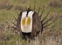
Greater Sage-Grouse
Centrocercus urophasianus
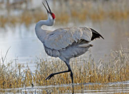
Greater Sandhill Crane
Antigone canadensis tabida
Grimy Ivesia
Ivesia rhypara var. rhypara
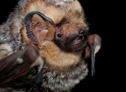
Hoary Bat
Lasiurus cinereus
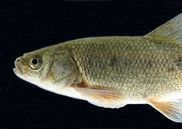
Hutton Spring Tui Chub
Siphateles bicolor oregonensis
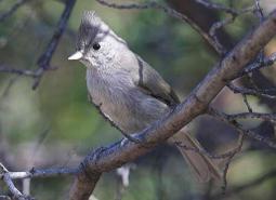
Juniper Titmouse
Baeolophus ridgwayi
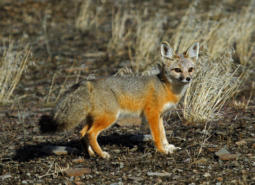
Kit Fox
Vulpes macrotis
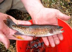
Lahontan Cutthroat Trout
Oncorhynchus clarki henshawi
Lahontan Cutthroat Trout, Coyote Lake SMU
Oncorhynchus clarki henshawi
Lahontan Cutthroat Trout, Quinn River SMU
Oncorhynchus clarki henshawi
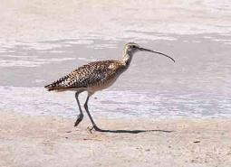
Long-billed Curlew
Numenius americanus

Long-legged Myotis
Myotis volans
Malheur Cave Amphipod
Stygobromus hubbsi
Malheur Cave Flatworm
Kenkia rhynchida
Malheur Cave Springtail
Oncopodura mala
Malheur Isopod
Amerigoniscus malheurensis
Malheur Pseudoscorpion
Apochthonius malheuri
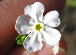
Malheur Valley Fiddleneck
Amsinckia carinata
Malheur Wire-lettuce
Stephanomeria malheurensis
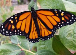
Monarch Butterfly
Danaus plexippus
Mountain Quail
Oreortyx pictus
Mulford’s Milkvetch
Astragalus mulfordiae
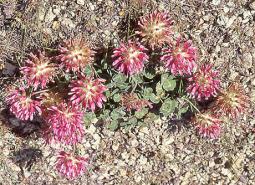
Owyhee Clover
Trifolium owyheense
Packard’s Mentzelia
Mentzelia packardiae

Pallid Bat
Antrozous pallidus
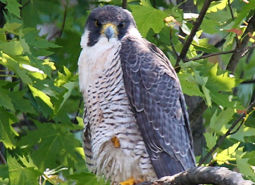
Peregrine Falcon
Falco peregrinus anatum
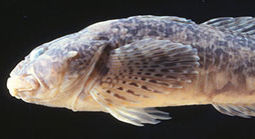
Pit Sculpin
Cottus pitensis
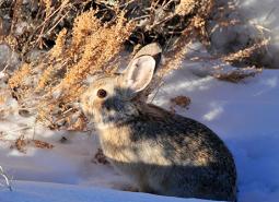
Pygmy Rabbit
Brachylagus idahoensis
Silver-haired Bat
Lasionycteris noctivagans
Smooth Mentzelia
Mentzelia mollis
Snake River Goldenweed
Pyrrocoma radiata
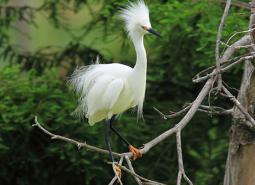
Snowy Egret
Egretta thula
Spotted Bat
Euderma maculatum
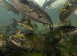
Spring Chinook Salmon, Upper Snake SMU
Oncorhynchus tshawytscha
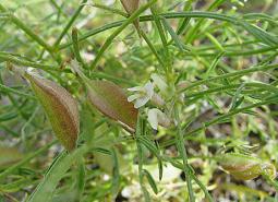
Sterile Milkvetch
Astragalus cusickii var. sterilis
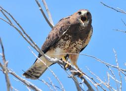
Swainson’s Hawk
Buteo swainsoni
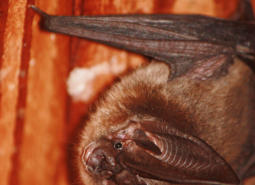
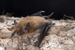
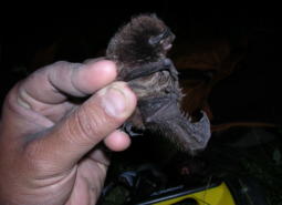
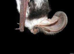
Townsend’s Big-eared Bat
Corynorhinus townsendii
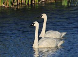
Trumpeter Swan
Cygnus buccinator
Warner Sucker
Catostomus warnerensis
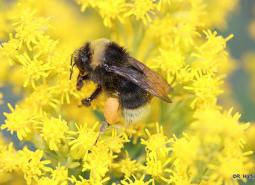
Western Bumble Bee
Bombus occidentalis
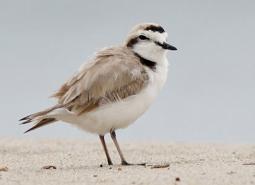
Western Snowy Plover
Charadrius nivosus nivosus
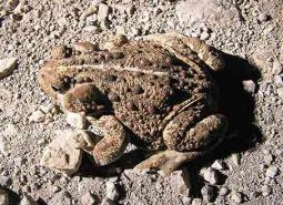
Western Toad
Anaxyrus boreas
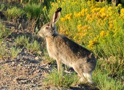
White-tailed Jackrabbit
Lepus townsendii
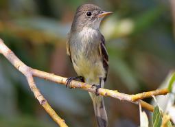
Willow Flycatcher
Empidonax traillii
Conservation Opportunity Areas
Alkali Lake [COA ID: 190]
Encompassing Alkali Lake, this COA is the smallest in the Northern Basin and Range ecoregion. It is located north of Lake Abert and just west of US Highway 395 in eastern Lake County.
Alvord Lake Basin [COA ID: 194]
The northern extent of this long narrow COA includes Tudor Lake at the eastern base of Steens Mountain. Continuing south and encompassing a large swath of the Alvord Desert, including the seasonal and alkali Alvord Lake, the COA ends just south of the community of Fields in the Pueblo Valley.
Basque Hills Area Plains [COA ID: 202]
Barely crossing into Lake County on its western edge, This COA is predominantly located in southwestern Harney County and connects to the Sage Hen Creek COA (201) and the Hart Mountain Area COA (200) on its western and southeastern borders. It encompasses an area from Mahogany Mountain in the north to the southern edge of …
Brothers-North Wagontire [COA ID: 184]
The northern extent of this COA includes the Bear Creek Buttes and Rodman Rim area in the Ochoco Mountain foothills. South of US Highway 20, the COA encompasses Pine Mountain and a large area of sagebrush steppe dotted by numerous buttes north of Christmas Valley. Heading east it covers Elk Mountain and Rams Butte before …
Bully Creek Area [COA ID: 183]
Adjacent to North Fork Malheur – Monument Rock area, including significant stretches of Clover Creek and Bully Creek
Chewaucan River [COA ID: 141]
Area includes the Chewaucan River and surrounding habitats
Crowley [COA ID: 185]
This rugged COA begins in Harney County near the confluence of Crane Creek and the South Fork Malheur River. Moving north east, the COA crosses into Malheur County and wraps around Swamp Creek Buttes. Continuing north towards Juntura, it then follows an eastward line (south of US Highway 20) towards Namorf. Finally, the COA heads …
Foster Flat-Black Rim Sagebrush Area [COA ID: 191]
Located in the Foster Flat area, south of Harney Lake and west of US Highway 205, this COA encompasses large areas of sagebrush steppe shrublands and scattered wetlands.
Harney-Malheur Area [COA ID: 187]
This COA encompasses both Harney and Malheur Lakes at the north end and then heads south along the Donner and Blitzen River and Blitzen Valley. An eastern finger of the COA continues out of the valley as far as the town of Diamond and the southern finger ends near French Glen.
Hart Mountain Area [COA ID: 200]
Mainly located in south eastern Lake County, this COA encompasses an area from the Oregon/Nevada border in the south; Coleman Valley and Warner Valley in the west; Guano Valley and Mahogany Butte in the east, and across to the southeastern corner of Hart Mountain National Antelope Refuge in the north. The COA includes several protected …
Jordan Creek Wetlands [COA ID: 195]
Located in east-central Malheur County, this small COA encompasses Jorden Valley and the surrounding hills, from the Oregon/Idaho border west into Jordan Creek Canyon.
Lake Abert [COA ID: 197]
Located in central Lake County, this COA encompasses Lake Abert, including the Lake Abert Area of Critical Environmental Concern and portions of the Abert Rim Wilderness Study Area.
Little Louse Canyon [COA ID: 205]
Located in Southeastern Malheur County, this western extent of this COA includes High Peak and Battle Mountain; the eastern edge is found close to Louse Creek; its northern extent is approximately five miles north of Big Antelope Creek – before its confluence with the Owyhee River; and the southern border includes the upper reaches of Big Antelope …
Long Creek-Coyote Creek-Silver Creek [COA ID: 135]
Area comprised of three major sub-watersheds immediately adjacent to Sycan Marsh, including river confluence.
Malheur River Headwaters [COA ID: 180]
The Malheur River Headwaters COA spans two ecoregions. Within the BM ecoregion, the COA includes Logan Valley and part of the Strawberry Mountain Wilderness and continues south to Battle Mountain (just north of Highway 306). Within the NBR, the COA is comprised of land associated with the Malheur River south of Battle Mountain to approximately …
Middle Owyhee River Area [COA ID: 186]
This COA is located in the northeast quarter of Malheur County and abuts the Crowley COA to the west. It encompasses Owyhee Lake and River from just east of Mitchell Butte (near the city of Adrian) south to Greeley Bar. Continuing south and east, the COA includes the rugged landscape of Mahogany Mountain, Jordan Craters, …
Pueblo Mountain [COA ID: 203]
This COA encompasses the southern Oregon Pueblo Mountains from Cottonwood Creek in the north to the Monument Basin in the southwest and then east across the Pueblo Valley towards the foothills of the Trout Creek Mountains. It includes the Pueblo Mountain Wilderness Study Area; the Tum Tum Lake Research Natural Area, and the Pueblo Hills …
Quartz Mountain [COA ID: 131]
Includes significant wetland and wet meadow areas. Immediately adjacent to NB COA “Brothers – North Wagontire”.
Rattlesnake Creek-Calamity Creek Area [COA ID: 181]
At the border of Grant and Harney County, area encompasses important sections of Rattlesnake Creek and Calamity Creek, immediately adjacent to the Silvies River COA
Sage Hen Creek [COA ID: 201]
Located in the southeast corner of Lake County and the southwest corner of Harney County, this COA encompasses the southern and eastern portion of Guano Valley and continues east from Guano Rim to the foothills of Bald Mountain and Acty Mountain. It includes the Spaulding and Hawk Mountain Wilderness Study Areas and the Hawksie-Walksie Research …
Silver Creek Area [COA ID: 175]
Located at the southern edge of the Blue Mountains Ecoregion, just west of the Silvies River. Area includes ecologically significant stretch of Silver Creek and its surrounding habitat
Soldier Creek-Upper Owyhee River [COA ID: 196]
The eastern edge of this COA follows the Oregon/Idaho border from the Jordan Valley area south to the North Fork Owyhee River. It then moves west and north into the Owyhee Canyon, and includes the Spring Creek watershed and the Oregon portion of the Soldier Creek watershed. Finally, the COA covers most of Antelope Reservoir …
South Fork Crooked River Area [COA ID: 174]
At the southern edge of the ecoregion, adjacent to several COAs and slightly west of the town of Burns
Steens Mountain [COA ID: 192]
This COA includes much of Steens Mountain’s southwestern flank before moving north and skirting along the edge of Malheur National Wildlife Refuge and then east into the northern Steens Mountain uplands and High Lava Plains.
Summer Lake Area [COA ID: 189]
This area is comprised of Summer Lake and the surrounding high desert wetlands subregion, including much of the Diablo Mountain Wilderness Study Area.
Ten Cent Lake-Juniper Lake Area [COA ID: 193]
This COA encompasses an area south of US Highway 78 that spans Malheur and Harney Counties from the Sheepshead mountains in the east to Burnt Flat and Comegys Lake on the northern flank of Steens Mountain.
Three Forks [COA ID: 206]
This is the most southeastern COA in Oregon and shares borders with Idaho and Nevada. It includes significant sections of the main stem Owyhee River, the Middle Fork Owyhee River, Little Owyhee River, and Toppin Creek. Its northern extent includes the three forks confluence, and its western border abuts the Little Louse Canyon COA (205) …
Trout Creek Mountains [COA ID: 204]
Spanning an area in the southeastern corner Harney County and southwestern Malheur County, this COA encompasses the Trout Creek Mountains, the Oregon Canyon Mountains, and the Blue Mountains. It includes numerous Wilderness Study Areas, such as Disaster Peak, Alvord Desert, Fifteenmile Creek, Mahogany Ridge, Oregon Canyon, Twelvemile Creek, and Willow Creek.
Upper Silvies River [COA ID: 178]
Includes significant stretch of the Silvies River and surrounding habitat. Spans Blue Mountains (bounded at the north by the town of Seneca) and Northern Basin & Range Ecoregion (starting at Malheur Lake to the south), passing through the town of Burns
Upper South Fork Malheur Area [COA ID: 188]
This COA straddles US Highway 78 southeast of Malheur Lake and provides connectivity between the Crowley (185) COA, Ten Cent Lake-Juniper Lake Area (193) COA, and the Steens Mountain High Lava Plains (192) COA. North of US Highway 78 the COA includes Malheur Cave and a section of South Fork Malheur River. South of 78 …
Warner Basin Wetlands [COA ID: 199]
Encompassing Warner Valley and associated wetlands, this COA stretches from just above Blue Joint Lake in the north to the Oregon/Nevada border in the south, and includes the Rahilly-Gravelly Research Natural Area, the Fish Creek Rim Research Natural Area, and the Warner Wetlands Area Of Critical Environmental Concern.
Warner Mountains [COA ID: 146]
Area located east of Lakeview along the eastern border of the ecoregion
Warner West [COA ID: 198]
This COA includes portion of Abert Rim Wilderness Study Area, Fish Creek Rim Wilderness Study Area, Lake Abert Area of Critical Environmental Concern, and the Fish Creek Rim Research Natural Area. It encompasses an area between Abert Rim and the Warner Mountains on the western edge to South Warner Rim and Lynches Rim to the …
Willow Creek-Birch Creek Area [COA ID: 167]
Located between the towns of Brogan and Huntington, at the eastern border of the ecoregion adjacent to the Snake River